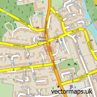
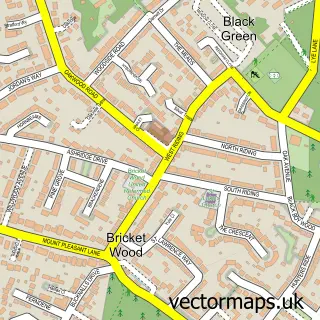
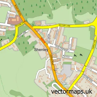
This Park Street street map is a detailed vector street map covering a 750m x 750m area. Select a larger area to create and download your own vector street map of Park Street.
The 750-metre map sample for Park Street covers 195 mapped buildings and approximately 7.3 km of road detail, of which 15 named roads are named. The immediate area includes 1 railway station, 5 GP surgeries within 2 miles, 3 pubs and 1 MOT station, with 10 within 2 miles. The wider area around Park Street features 2 tourism points of interest and 4 food and drink venues. To create a larger or custom map of Park Street, the map builder lets you define your own coverage area and download editable SVG, PDF and PNG files.
Create a larger editable map of Park Street
Choose any area you need and generate a high-quality vector map instantly. Perfect for print, planning, design, business and personal use.

This Park Street street map in Hertfordshire is available as downloadable SVG, PDF and PNG map files, or as a printed map for planning, business, display, education, local information and design work. You can also create a larger custom map area using the map selector.
What this Park Street map sample shows
Park Street lies within St. Stephen Cp parish, part of Park Street ward in the St. Albans District (B) local authority area. The postcode geography for this area includes the AL postcode area, the AL2 postcode district and the AL2 2 postcode sector. Residents fall under the Nhs Hertfordshire And West Essex Integrated Care Board for NHS services.
Local features near Park Street
Within 2 milesAmenities and services in and around Park Street.
Administrative and postcode information for Park Street
Park Street lies within St. Stephen Cp parish, part of Park Street ward in the St. Albans District (B) local authority area. The postcode geography for this area includes the AL postcode area, the AL2 postcode district and the AL2 2 postcode sector. Residents fall under the Nhs Hertfordshire And West Essex Integrated Care Board for NHS services.
Nearby street map samples around Park Street

More street maps in Hertfordshire
750 metre map area coverage
Boundary, postcode and point of interest information for the 750m x 750m rectangle centred on this sample map.
Boundaries containing map centre
Constituency: St. Albans Co Const
County: Hertfordshire County
District: St. Albans District (B)
Icb: NHS Central East ICB
Parish: St. Stephen CP
Police Force: hertfordshire
Postcode District: AL2
Postcode Sector: AL2 2
Ward: Park Street Ward
Nearby boundaries intersecting sample
No additional intersecting boundaries found.
Postcode coverage
POI category counts
Pub: 3
Train Station: 3
Building Supply Store: 2
Car Wash: 2
Contractor: 2
It Service And Computer Repair: 2
Pest Control Service: 2
Pet Groomer: 2
Advertising Agency: 1
Auto Electrical Repair: 1
Sample points of interest
- David Barnett Associates
- I D C Electrical Services
- SSL
- Divinely Vintage
- Park Street Barbers
- Phd Salon
- Boyle Brickwork
- Idc Electrical Services
- Magic Car Wash
- Park Street Car Wash
- Park Street Village Hall
- Drywall Solutions Ltd
Create a larger editable map of Park Street
This sample shows only a 750 metre area. To create a larger map of Park Street, use our map builder to choose your own coverage area, add titles and download editable SVG, PDF and PNG files.
Create a custom map of Park Street