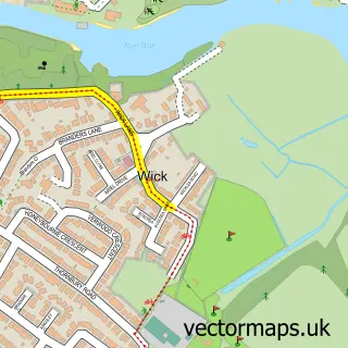
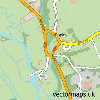
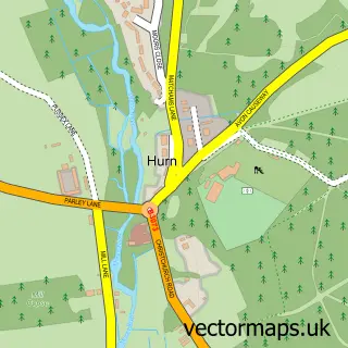
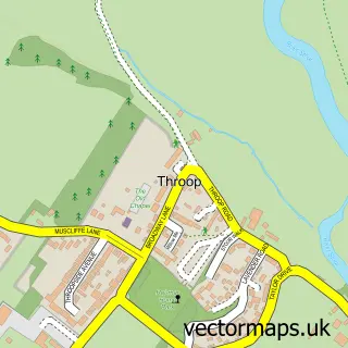
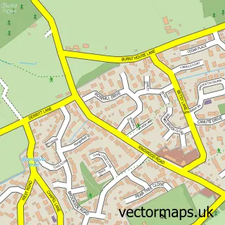
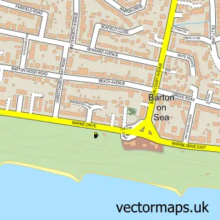
This Christchurch street map is a detailed vector street map covering a 750m x 750m area. Select a larger area to create and download your own vector street map of Christchurch.
The 750-metre map sample for Christchurch covers 294 mapped buildings and approximately 14.6 km of road detail, of which 29 named roads are named. The immediate area includes 1 primary school and 1 secondary school, 1 GP surgery, with 7 within 2 miles, 6 pubs and 25 MOT stations within 2 miles. The wider area around Christchurch features 13 tourism points of interest, 31 food and drink venues and 2 hotels. To create a larger or custom map of Christchurch, the map builder lets you define your own coverage area and download editable SVG, PDF and PNG files.
Create a larger editable map of Christchurch
Choose any area you need and generate a high-quality vector map instantly. Perfect for print, planning, design, business and personal use.

This Christchurch street map in Dorset is available as downloadable SVG, PDF and PNG map files, or as a printed map for planning, business, display, education, local information and design work. You can also create a larger custom map area using the map selector.
What this Christchurch map sample shows
Christchurch lies within Christchurch Cp parish, part of Christchurch Town ward in the Bournemouth, Christchurch And Poole local authority area. The postcode geography for this area includes the BH postcode area, the BH23 postcode district and the BH23 1 postcode sector. Residents fall under the Nhs Dorset Integrated Care Board for NHS services.
Local features near Christchurch
Within 2 milesAmenities and services in and around Christchurch.
Administrative and postcode information for Christchurch
Christchurch lies within Christchurch Cp parish, part of Christchurch Town ward in the Bournemouth, Christchurch And Poole local authority area. The postcode geography for this area includes the BH postcode area, the BH23 postcode district and the BH23 1 postcode sector. Residents fall under the Nhs Dorset Integrated Care Board for NHS services.
Nearby street map samples around Christchurch

More street maps in Dorset
750 metre map area coverage
Boundary, postcode and point of interest information for the 750m x 750m rectangle centred on this sample map.
Boundaries containing map centre
Constituency: Christchurch Co Const
District: Bournemouth, Christchurch and Poole
Icb: NHS Dorset ICB
Parish: Christchurch CP
Police Force: dorset
Postcode District: BH23
Postcode Sector: BH23 1
Ward: Christchurch Town Ward
Nearby boundaries intersecting sample
Postcode Sector: BH23 7
Postcode coverage
POI category counts
Cafe: 13
Flowers And Gifts Shop: 10
Beauty Salon: 9
Coffee Shop: 8
Hair Salon: 8
Jewelry Store: 8
Barber: 7
Beauty And Spa: 7
Clothing Store: 7
Professional Services: 7
Sample points of interest
- Chorus Accounting
- Lewis Ball And Co.
- Paget Reid York
- Southern Payroll Services
- TaxAssist Accountants
- Christchurch Tokon Shotokan Karate Academy
- 3t Creative
- Dh Websites
- Route2Marketing
- Bournemouth Airport Transfers
- Dorset Dockers RFC
- Christchurch Priory
Create a larger editable map of Christchurch
This sample shows only a 750 metre area. To create a larger map of Christchurch, use our map builder to choose your own coverage area, add titles and download editable SVG, PDF and PNG files.
Create a custom map of Christchurch