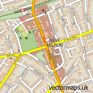
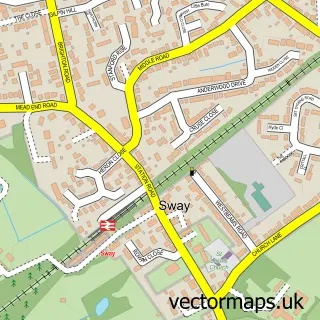
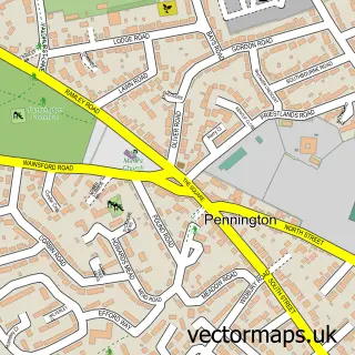
This Barton on Sea street map is a detailed vector street map covering a 750m x 750m area. Select a larger area to create and download your own vector street map of Barton on Sea.
The 750-metre map sample for Barton on Sea covers 401 mapped buildings and approximately 13.4 km of road detail, of which 26 named roads are named. The immediate area includes 2 GP surgeries within 2 miles and 7 MOT stations within 2 miles. The wider area around Barton on Sea features 1 tourism point of interest, 4 food and drink venues and 2 hotels. To create a larger or custom map of Barton on Sea, the map builder lets you define your own coverage area and download editable SVG, PDF and PNG files.
Create a larger editable map of Barton on Sea
Choose any area you need and generate a high-quality vector map instantly. Perfect for print, planning, design, business and personal use.

This Barton on Sea street map in Hampshire is available as downloadable SVG, PDF and PNG map files, or as a printed map for planning, business, display, education, local information and design work. You can also create a larger custom map area using the map selector.
What this Barton on Sea map sample shows
Barton on Sea lies within New Milton Cp parish, part of Becton ward in the New Forest District local authority area. The postcode geography for this area includes the BH postcode area, the BH25 postcode district and the BH25 7 postcode sector. Residents fall under the Nhs Hampshire And Isle Of Wight Integrated Care Board for NHS services.
Local features near Barton on Sea
Within 2 milesAmenities and services in and around Barton on Sea.
Administrative and postcode information for Barton on Sea
The local authority covering Barton on Sea is New Forest District, within the county of Hampshire. The settlement lies within Becton ward and New Milton Cp civil parish. The BH25 postcode district and BH25 7 postcode sector serve the immediate area. NHS provision in the area is delivered through University Hospitals Dorset Nhs Foundation Trust.
Nearby street map samples around Barton on Sea

More street maps in Hampshire
750 metre map area coverage
Boundary, postcode and point of interest information for the 750m x 750m rectangle centred on this sample map.
Boundaries containing map centre
Constituency: New Forest West Co Const
County: Hampshire County
District: New Forest District
Icb: NHS Hampshire and Isle of Wight ICB
Parish: New Milton CP
Police Force: hampshire
Postcode District: BH25
Postcode Sector: BH25 7
Ward: Barton & Becton Ward
Nearby boundaries intersecting sample
No additional intersecting boundaries found.
Postcode coverage
POI category counts
Beach: 4
Books Mags Music And Video: 2
Buddhist Temple: 2
Building Supply Store: 2
Coffee Shop: 2
Hotel: 2
Medical Center: 2
Beauty Salon: 1
Business Management Services: 1
Cafe: 1
Sample points of interest
- Barton on Sea Beach Access
- Bournemouth Hengistbury West Beach
- Cliff Top Barton On Sea
- New Milton beach
- Reds Hair Nails and Beauty
- Post Office-Sea Road
- Sea Road Post Office
- Watpa Tesarangsee UK
- Watpatesarangsee UK วัดป่าเทสรังสี สหราชอาณาจักร
- Desmil Property Maintenance Ltd
- Steve Milbery Carpets
- Bathroom Design Centre Ltd.
Create a larger editable map of Barton on Sea
This sample shows only a 750 metre area. To create a larger map of Barton on Sea, use our map builder to choose your own coverage area, add titles and download editable SVG, PDF and PNG files.
Create a custom map of Barton on Sea