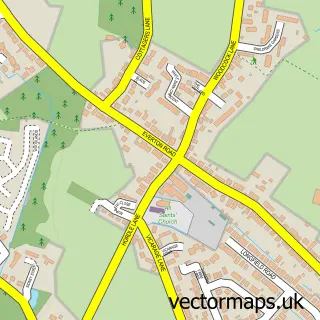
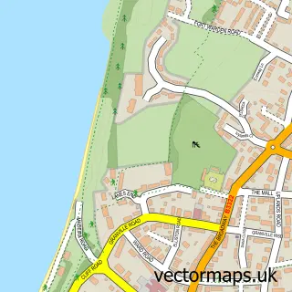
This Milford on Sea street map is a detailed vector street map covering a 750m x 750m area. Select a larger area to create and download your own vector street map of Milford on Sea.
The 750-metre map sample for Milford on Sea covers 531 mapped buildings and approximately 15.2 km of road detail, of which 40 named roads are named. The immediate area includes 7 pubs and 1 MOT station, with 4 within 2 miles. The wider area around Milford on Sea features 2 tourism points of interest, 14 food and drink venues and 3 hotels. To create a larger or custom map of Milford on Sea, the map builder lets you define your own coverage area and download editable SVG, PDF and PNG files.
Create a larger editable map of Milford on Sea
Choose any area you need and generate a high-quality vector map instantly. Perfect for print, planning, design, business and personal use.

This Milford on Sea street map in Hampshire is available as downloadable SVG, PDF and PNG map files, or as a printed map for planning, business, display, education, local information and design work. You can also create a larger custom map area using the map selector.
What this Milford on Sea map sample shows
Milford on Sea lies within Milford-On-Sea Cp parish, part of Milford ward in the New Forest District local authority area. The postcode geography for this area includes the SO postcode area, the SO41 postcode district and the SO41 0 postcode sector. Residents fall under the Nhs Hampshire And Isle Of Wight Integrated Care Board for NHS services.
Local features near Milford on Sea
Within 2 milesAmenities and services in and around Milford on Sea.
Administrative and postcode information for Milford on Sea
Milford on Sea lies within Milford-On-Sea Cp parish, part of Milford ward in the New Forest District local authority area. The postcode geography for this area includes the SO postcode area, the SO41 postcode district and the SO41 0 postcode sector. Residents fall under the Nhs Hampshire And Isle Of Wight Integrated Care Board for NHS services.
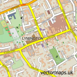
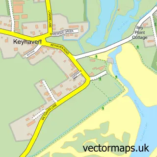
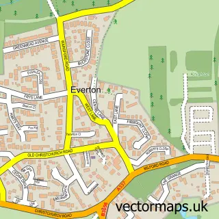
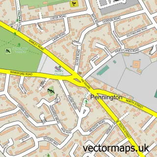
Nearby street map samples around Milford on Sea

More street maps in Hampshire
750 metre map area coverage
Boundary, postcode and point of interest information for the 750m x 750m rectangle centred on this sample map.
Boundaries containing map centre
Constituency: New Forest West Co Const
County: Hampshire County
District: New Forest District
Icb: NHS Hampshire and Isle of Wight ICB
Parish: Milford-on-Sea CP
Police Force: hampshire
Postcode District: SO41
Postcode Sector: SO41 0
Ward: Milford & Hordle Ward
Nearby boundaries intersecting sample
No additional intersecting boundaries found.
Postcode coverage
POI category counts
Cafe: 7
Pub: 7
Hair Salon: 4
Automotive: 3
Automotive Repair: 3
Bakery: 3
Convenience Store: 3
Flowers And Gifts Shop: 3
Hotel: 3
Pet Store: 3
Sample points of interest
- A2B Book Keeping Services
- All Saints’, Milford on Sea
- Brocante
- Noah Valentine Antiques and Collectables
- Jabulani Gallery
- The Southern Co-Operative Milford on Sea High Street
- Abbey Yachts
- Cars 4 U Lymington
- Forrest Rescue
- Digifix Autos
- Milford Bodyworks
- The Garage
Create a larger editable map of Milford on Sea
This sample shows only a 750 metre area. To create a larger map of Milford on Sea, use our map builder to choose your own coverage area, add titles and download editable SVG, PDF and PNG files.
Create a custom map of Milford on Sea