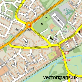
This Croft street map is a detailed vector street map covering a 750m x 750m area. Select a larger area to create and download your own vector street map of Croft.
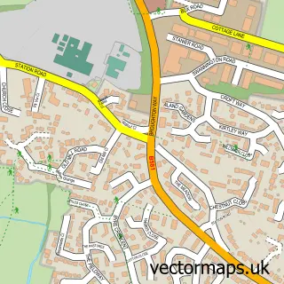
The 750-metre map sample for Croft covers 377 mapped buildings and approximately 24.0 km of road detail, of which 24 named roads are named. The immediate area includes 1 school, 2 GP surgeries within 2 miles, 2 pubs and 6 MOT stations within 2 miles. The wider area around Croft features 1 tourism point of interest, 3 food and drink venues and 1 campsite within 2 miles. To create a larger or custom map of Croft, the map builder lets you define your own coverage area and download editable SVG, PDF and PNG files.
Create a larger editable map of Croft
Choose any area you need and generate a high-quality vector map instantly. Perfect for print, planning, design, business and personal use.

This Croft street map in Leicestershire is available as downloadable SVG, PDF and PNG map files, or as a printed map for planning, business, display, education, local information and design work. You can also create a larger custom map area using the map selector.
What this Croft map sample shows
Croft lies within Croft Cp parish, part of Croft Hill ward in the Blaby District local authority area. The postcode geography for this area includes the LE postcode area, the LE9 postcode district and the LE9 3 postcode sector. Residents fall under the Nhs Leicester, Leicestershire And Rutland Integrated Care Board for NHS services.
Local features near Croft
Within 2 milesAmenities and services in and around Croft.
Administrative and postcode information for Croft
The local authority covering Croft is Blaby District, within the county of Leicestershire. The settlement lies within Croft Hill ward and Croft Cp civil parish. The LE9 postcode district and LE9 3 postcode sector serve the immediate area. NHS provision in the area is delivered through University Hospitals Of Leicester Nhs Trust.
Nearby street map samples around Croft

More street maps in Leicestershire
750 metre map area coverage
Boundary, postcode and point of interest information for the 750m x 750m rectangle centred on this sample map.
Boundaries containing map centre
Constituency: South Leicestershire Co Const
County: Leicestershire County
District: Blaby District
Icb: NHS Leicester Leicestershire and Rutland ICB
Parish: Croft CP
Police Force: leicestershire
Postcode District: LE9
Postcode Sector: LE9 3
Ward: Fosse Stoney Cove Ward
Nearby boundaries intersecting sample
No additional intersecting boundaries found.
Postcode coverage
POI category counts
Beauty Salon: 4
Convenience Store: 3
Preschool: 3
Professional Services: 3
Sports And Recreation Venue: 3
Bakery: 2
Business Management Services: 2
Contractor: 2
Education: 2
Engineering Services: 2
Sample points of interest
- Croft: St Michael & All Angels
- J Webb White Goods Services
- PayPoint
- Classic Car Services Ltd
- Lavender's Blue
- The Wooded Town Bakery
- Croft Hair & Beauty
- Beauty and Aesthetics with Milly
- Beauty with Milly
- Elle Jai's Nails
- anGELic Nails By Liz
- Knappstone
Create a larger editable map of Croft
This sample shows only a 750 metre area. To create a larger map of Croft, use our map builder to choose your own coverage area, add titles and download editable SVG, PDF and PNG files.
Create a custom map of Croft