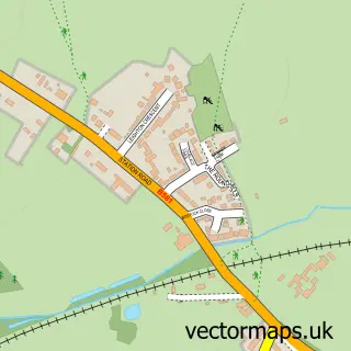
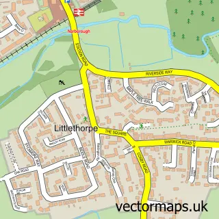
This Potters Marston street map is a detailed vector street map covering a 750m x 750m area. Select a larger area to create and download your own vector street map of Potters Marston.
The 750-metre map sample for Potters Marston covers 11 mapped buildings and approximately 7.3 km of road detail, of which 2 named roads are named. The immediate area includes 1 GP surgery within 2 miles and 3 MOT stations within 2 miles. The wider area around Potters Marston features 1 campsite within 2 miles. To create a larger or custom map of Potters Marston, the map builder lets you define your own coverage area and download editable SVG, PDF and PNG files.
Create a larger editable map of Potters Marston
Choose any area you need and generate a high-quality vector map instantly. Perfect for print, planning, design, business and personal use.

This Potters Marston street map in Leicestershire is available as downloadable SVG, PDF and PNG map files, or as a printed map for planning, business, display, education, local information and design work. You can also create a larger custom map area using the map selector.
What this Potters Marston map sample shows
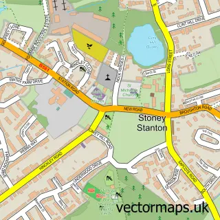
Potters Marston lies within Stoney Stanton Cp parish, part of Stanton And Flamville ward in the Blaby District local authority area. The postcode geography for this area includes the LE postcode area, the LE9 postcode district and the LE9 4 postcode sector. Residents fall under the Nhs Leicester, Leicestershire And Rutland Integrated Care Board for NHS services.
Local features near Potters Marston
Within 2 milesAmenities and services in and around Potters Marston.
Administrative and postcode information for Potters Marston
The local authority covering Potters Marston is Blaby District, within the county of Leicestershire. The settlement lies within Stanton And Flamville ward and Stoney Stanton Cp civil parish. The LE9 postcode district and LE9 4 postcode sector serve the immediate area. NHS provision in the area is delivered through University Hospitals Of Leicester Nhs Trust.
Nearby street map samples around Potters Marston

More street maps in Leicestershire
750 metre map area coverage
Boundary, postcode and point of interest information for the 750m x 750m rectangle centred on this sample map.
Boundaries containing map centre
Constituency: South Leicestershire Co Const
County: Leicestershire County
District: Blaby District
Icb: NHS Leicester Leicestershire and Rutland ICB
Parish: Potters Marston CP
Police Force: leicestershire
Postcode District: LE9
Postcode Sector: LE9 3
Ward: Fosse Stoney Cove Ward
Nearby boundaries intersecting sample
Constituency: Hinckley and Bosworth Co Const
District: Hinckley and Bosworth District (B)
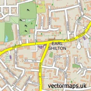
Parish: Earl Shilton CP, Stoney Stanton CP
Postcode Sector: LE9 4, LE9 7
Ward: Earl Shilton Ward
Postcode coverage
POI category counts
Anglican Church: 1
Auto Loan Provider: 1
Contractor: 1
Education: 1
Event Planning: 1
It Service And Computer Repair: 1
Professional Services: 1
Self Storage Facility: 1
Sample points of interest
- St Mary
- Mortgages Made Easy
- The Commercial Flooring Company
- E Q V
- Dovecote Court
- Midland Technologies
- Power on Connections
- Dovecote Self Storage
Create a larger editable map of Potters Marston
This sample shows only a 750 metre area. To create a larger map of Potters Marston, use our map builder to choose your own coverage area, add titles and download editable SVG, PDF and PNG files.
Create a custom map of Potters Marston