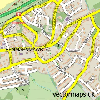
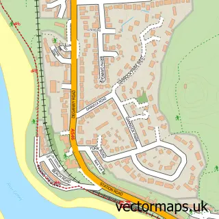
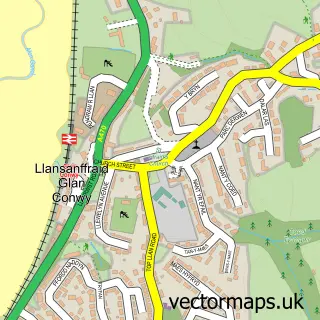
This Dwygyfylchi street map is a detailed vector street map covering a 750m x 750m area. Select a larger area to create and download your own vector street map of Dwygyfylchi.
The 750-metre map sample for Dwygyfylchi covers 313 mapped buildings and approximately 14.4 km of road detail, of which 11 named roads are named. The immediate area includes 1 school and 1 MOT station within 2 miles. The wider area around Dwygyfylchi features 1 food and drink venue, 2 hotels and 3 campsites within 2 miles. To create a larger or custom map of Dwygyfylchi, the map builder lets you define your own coverage area and download editable SVG, PDF and PNG files.
Create a larger editable map of Dwygyfylchi
Choose any area you need and generate a high-quality vector map instantly. Perfect for print, planning, design, business and personal use.

This Dwygyfylchi street map in Clwyd is available as downloadable SVG, PDF and PNG map files, or as a printed map for planning, business, display, education, local information and design work. You can also create a larger custom map area using the map selector.
What this Dwygyfylchi map sample shows
Dwygyfylchi lies within Penmaenmawr Community parish, part of Capelulo ward in the Conwy - Conwy local authority area. The postcode geography for this area includes the LL postcode area, the LL34 postcode district and the LL34 6 postcode sector. Residents fall under the Betsi Cadwaladr University Health Board for NHS services.
Local features near Dwygyfylchi
Within 2 milesAmenities and services in and around Dwygyfylchi.
Administrative and postcode information for Dwygyfylchi
The local authority covering Dwygyfylchi is Conwy - Conwy, within the county of Clwyd. The settlement lies within Capelulo ward and Penmaenmawr Community civil parish. The LL34 postcode district and LL34 6 postcode sector serve the immediate area. NHS provision in the area is delivered through Betsi Cadwaladr University Health Board.
Nearby street map samples around Dwygyfylchi

More street maps in Clwyd
750 metre map area coverage
Boundary, postcode and point of interest information for the 750m x 750m rectangle centred on this sample map.
Boundaries containing map centre
Constituency: Bangor Aberconwy Co Const
District: Conwy - Conwy
Icb: Betsi Cadwaladr University
Parish: Penmaenmawr Community
Police Force: north wales
Postcode District: LL34
Postcode Sector: LL34 6
Nearby boundaries intersecting sample
No additional intersecting boundaries found.
Postcode coverage
POI category counts
School: 2
Beauty Salon: 1
Convenience Store: 1
Cottage: 1
Educational Services: 1
Electrician: 1
Fire Protection Service: 1
Flowers And Gifts Shop: 1
Golf Course: 1
Hotel: 1
Sample points of interest
- Crimpers Hair & Beauty
- Treforris superStores
- Warrandyte Cottage
- St. Gwynan's Pre-School
- NW Electrical Installations
- NW Fire Protection Ltd
- Raven Eve Designs
- Penmaenmawr Golf Club
- Dickinson Manor
- Quality Training Solutions U K
- The Gladstone
- Tyddyn Du Touring Park
Create a larger editable map of Dwygyfylchi
This sample shows only a 750 metre area. To create a larger map of Dwygyfylchi, use our map builder to choose your own coverage area, add titles and download editable SVG, PDF and PNG files.
Create a custom map of Dwygyfylchi