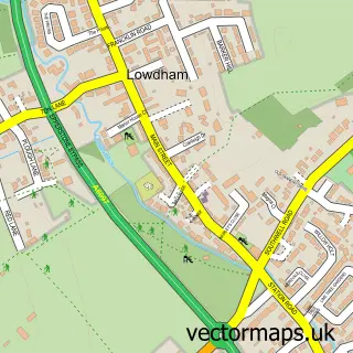
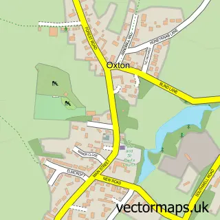
This Epperstone street map is a detailed vector street map covering a 750m x 750m area. Select a larger area to create and download your own vector street map of Epperstone.
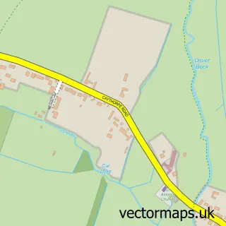
The 750-metre map sample for Epperstone covers 191 mapped buildings and approximately 12.3 km of road detail, of which 11 named roads are named. The immediate area includes 3 MOT stations within 2 miles. To create a larger or custom map of Epperstone, the map builder lets you define your own coverage area and download editable SVG, PDF and PNG files.
Create a larger editable map of Epperstone
Choose any area you need and generate a high-quality vector map instantly. Perfect for print, planning, design, business and personal use.

This Epperstone street map in Nottinghamshire is available as downloadable SVG, PDF and PNG map files, or as a printed map for planning, business, display, education, local information and design work. You can also create a larger custom map area using the map selector.
What this Epperstone map sample shows
Epperstone lies within Epperstone Cp parish, part of Dover Beck ward in the Newark And Sherwood District local authority area. The postcode geography for this area includes the NG postcode area, the NG14 postcode district and the NG14 6 postcode sector. Residents fall under the Nhs Nottingham And Nottinghamshire Integrated Care Board for NHS services.
Local features near Epperstone
Within 2 milesAmenities and services in and around Epperstone.
Administrative and postcode information for Epperstone
Epperstone lies within Epperstone Cp parish, part of Dover Beck ward in the Newark And Sherwood District local authority area. The postcode geography for this area includes the NG postcode area, the NG14 postcode district and the NG14 6 postcode sector. Residents fall under the Nhs Nottingham And Nottinghamshire Integrated Care Board for NHS services.
Nearby street map samples around Epperstone

More street maps in Nottinghamshire
750 metre map area coverage
Boundary, postcode and point of interest information for the 750m x 750m rectangle centred on this sample map.
Boundaries containing map centre
Constituency: Sherwood Forest Co Const
County: Nottinghamshire County
District: Newark and Sherwood District
Icb: NHS Nottingham and Nottinghamshire ICB
Parish: Epperstone CP
Police Force: nottinghamshire
Postcode District: NG14
Postcode Sector: NG14 6
Ward: Dover Beck Ward
Nearby boundaries intersecting sample
Constituency: Gedling Co Const
Parish: Woodborough CP
Postcode coverage
POI category counts
Accommodation: 1
Anglican Church: 1
Automotive Repair: 1
Building Supply Store: 1
Car Dealer: 1
Church Cathedral: 1
Community Center: 1
Industrial Equipment: 1
Landscaping: 1
Martial Arts Club: 1
Sample points of interest
- Epperstone Manor
- Holy Cross, Epperstone
- Classic Revival
- Grange View Landscaping
- Freshwood Trading
- Holy Cross Church
- Epperstone Village Hall
- Fresh Opportunities Ltd.
- Grange View Landscaping
- Nottingham Mushin Aikido
- Daisy Chain Pet Sitters
- Deans of Nottingham Properties
Create a larger editable map of Epperstone
This sample shows only a 750 metre area. To create a larger map of Epperstone, use our map builder to choose your own coverage area, add titles and download editable SVG, PDF and PNG files.
Create a custom map of Epperstone