Vector Maps logo
Home Why it works Popular maps Districts Samples Customizer Create Your Map
VectorMaps.uk
Home Popular maps Districts Samples Customizer Create Your Map Privacy Disclaimer
Home / UK Maps / West Yorkshire / Farsley Map

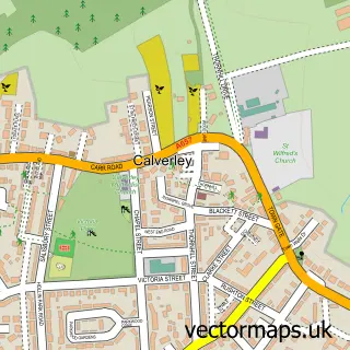
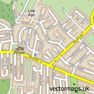
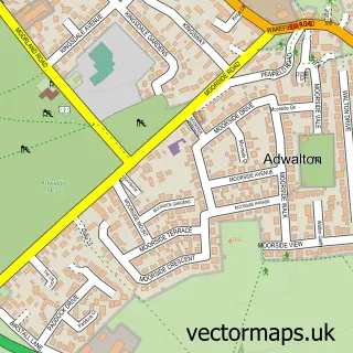
This Farsley street map is a detailed vector street map covering a 750m x 750m area. Select a larger area to create and download your own vector street map of Farsley.

Farsley is a town in West Yorkshire, in the Yorkshire And The Humber of England. Historically, the area formed part of Yorkshire. The settlement falls within the Pudsey parliamentary constituency. It is served by the LS28 postcode district, with LS28 5 as

The 750-metre map sample for Farsley covers 709 mapped buildings and approximately 21.8 km of road detail, of which 68 named roads are named. The immediate area includes 1 school, 9 GP surgeries within 2 miles, 9 pubs and 1 MOT station, with 24 within 2 miles. The wider area around Farsley features 4 tourism points of interest and 17 food and drink venues. To create a larger or custom map of Farsley, the map builder lets you define your own coverage area and download editable SVG, PDF and PNG files.

709Buildings
21.78 kmRoads
68Named roads
38,424Residents within 2 miles
Create your own

Create a larger editable map of Farsley

Choose any area you need and generate a high-quality vector map instantly. Perfect for print, planning, design, business and personal use.

Choose any location
Editable SVG files
Any size up to A0
PDF, PNG & more
Instant download
High quality guaranteed
Create My Custom Map
Secure, private & no credit card required
Farsley Vector Street Map
750m Sample
Farsley vector street map sample showing roads, buildings and local features in a 750 metre preview area
Buy Farsley Map Print from £12.95 Buy Farsley Digital Map from £6

This Farsley street map in West Yorkshire is available as downloadable SVG, PDF and PNG map files, or as a printed map for planning, business, display, education, local information and design work. You can also create a larger custom map area using the map selector.

What this Farsley map sample shows

Farsley lies within Leeds District (B) parish, part of Calverley & Farsley ward in the Leeds District (B) local authority area. The postcode geography for this area includes the LS postcode area, the LS28 postcode district and the LS28 5 postcode sector. Residents fall under the Nhs West Yorkshire Integrated Care Board for NHS services.

Local features near Farsley

Within 2 miles

Amenities and services in and around Farsley.

1 Schools
9 GP surgeries within 2 miles
1 MOT stations 24 within 2 miles
4 Tourism & leisure
17 Food & drink
9 Pubs
6 Healthcare POIs

Counts are approximate and based on publicly available data.

Administrative and postcode information for Farsley

The local authority covering Farsley is Leeds District (B), within the county of West Yorkshire. The settlement lies within Calverley & Farsley ward and Leeds District (B) civil parish. The LS28 postcode district and LS28 5 postcode sector serve the immediate area. NHS provision in the area is delivered through Leeds Teaching Hospitals Nhs Trust.

Parish LEEDS DISTRICT (B)
Ward Calverley & Farsley
District / local authority Leeds District (B)
County West Yorkshire
Historic county Yorkshire
Postcode district LS28
Postcode sector LS28 5
Parliamentary constituency Pudsey
Region Yorkshire and the Humber
Country England

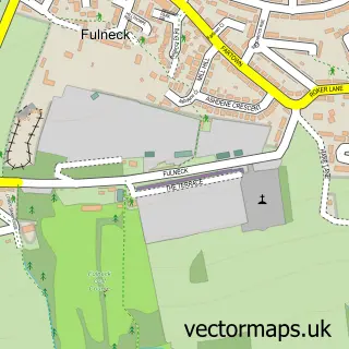
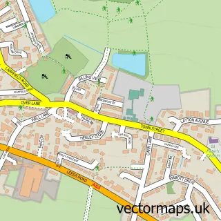
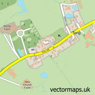
Nearby street map samples around Farsley

Street map sample of Bradford, West Yorkshire Bradford City - West Yorkshire - 3.6 miles Street map sample of Calverley, West Yorkshire Calverley Village - West Yorkshire - 1.3 miles Street map sample of Fulneck Moravian Settlement, West Yorkshire Fulneck Moravian Settlement Village - West Yorkshire - 2.1 miles Street map sample of Rawdon, West Yorkshire Rawdon Village - West Yorkshire - 2.5 miles Street map sample of Tong, West Yorkshire Tong Village - West Yorkshire - 3.0 miles Street map sample of Wrose, West Yorkshire Wrose Village - West Yorkshire - 3.5 miles Street map sample of Esholt, West Yorkshire Esholt Village - West Yorkshire - 3.8 miles Street map sample of Drighlington, West Yorkshire Drighlington Village - West Yorkshire - 4.0 miles Street map sample of Gildersome, West Yorkshire Gildersome Village - West Yorkshire - 4.2 miles Street map sample of Adwalton, West Yorkshire Adwalton Village - West Yorkshire - 4.4 miles

More street maps in West Yorkshire

Street map sample of Pudsey, West Yorkshire Pudsey Town - 1.3 miles Street map sample of Calverley, West Yorkshire Calverley Village - 1.3 miles Street map sample of Horsforth, West Yorkshire Horsforth Town - 2.1 miles Street map sample of Fulneck Moravian Settlement, West Yorkshire Fulneck Moravian Settlement Village - 2.1 miles Street map sample of Rawdon, West Yorkshire Rawdon Village - 2.5 miles

750 metre map area coverage

Boundary, postcode and point of interest information for the 750m x 750m rectangle centred on this sample map.

Boundaries containing map centre

Constituency: Leeds West and Pudsey Boro Const

District: Leeds District (B)

Icb: NHS West Yorkshire ICB

Police Force: west yorkshire

Postcode District: LS28

Postcode Sector: LS28 5

Ward: Calverley & Farsley Ward

Nearby boundaries intersecting sample

No additional intersecting boundaries found.

Postcode coverage

LS28 LS28 5

POI category counts

Professional Services: 10

Beauty Salon: 9

Pub: 9

Clothing Store: 7

Bakery: 6

Hair Salon: 6

Arts And Crafts: 5

Barber: 4

Building Supply Store: 4

Cafe: 4

Sample points of interest

  • F N Conversions Advertising Agency
  • Nucleus Signs Advertising Agency
  • fn Conversions Advertising Agency
  • New Park Joinery Appliance Manufacturer
  • Quicks Archery (Leeds) Archery Shop
  • LSW London Art Gallery
  • Bonds Of Farsley Arts And Crafts
  • Farsley D I Y Centre Arts And Crafts
  • Hoop Arts And Crafts
  • Mill Creations Farsley Arts And Crafts
  • Scrap Creative Reuse Arts Project Arts And Crafts
  • Mansfield Brewery Arts And Entertainment

Create a larger editable map of Farsley

This sample shows only a 750 metre area. To create a larger map of Farsley, use our map builder to choose your own coverage area, add titles and download editable SVG, PDF and PNG files.

Create a custom map of Farsley

Phone 01751 473136 | Copyright Vectormaps.uk 2026

Samples Customizer Privacy Disclaimer
Farsley Vector Street Map
Farsley enlarged street map sample showing a 750 metre preview area