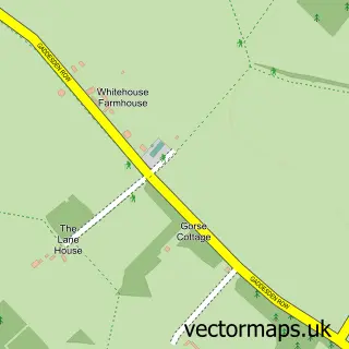
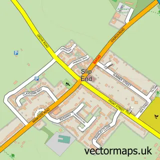
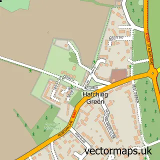
This Flamstead street map is a detailed vector street map covering a 750m x 750m area. Select a larger area to create and download your own vector street map of Flamstead.
The 750-metre map sample for Flamstead covers 226 mapped buildings and approximately 10.3 km of road detail, of which 15 named roads are named. The immediate area includes 4 pubs and 1 MOT station within 2 miles. The wider area around Flamstead features 4 food and drink venues. To create a larger or custom map of Flamstead, the map builder lets you define your own coverage area and download editable SVG, PDF and PNG files.
Create a larger editable map of Flamstead
Choose any area you need and generate a high-quality vector map instantly. Perfect for print, planning, design, business and personal use.

This Flamstead street map in Hertfordshire is available as downloadable SVG, PDF and PNG map files, or as a printed map for planning, business, display, education, local information and design work. You can also create a larger custom map area using the map selector.
What this Flamstead map sample shows
Flamstead lies within Flamstead Cp parish, part of Watling ward in the Dacorum District (B) local authority area. The postcode geography for this area includes the AL postcode area, the AL3 postcode district and the AL3 8 postcode sector. Residents fall under the Nhs Hertfordshire And West Essex Integrated Care Board for NHS services.
Local features near Flamstead
Within 2 milesAmenities and services in and around Flamstead.
Administrative and postcode information for Flamstead
Flamstead lies within Flamstead Cp parish, part of Watling ward in the Dacorum District (B) local authority area. The postcode geography for this area includes the AL postcode area, the AL3 postcode district and the AL3 8 postcode sector. Residents fall under the Nhs Hertfordshire And West Essex Integrated Care Board for NHS services.
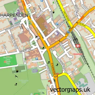
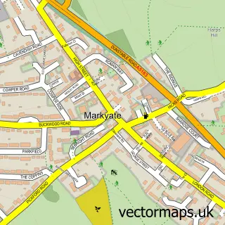
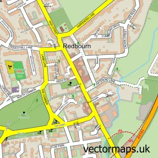
Nearby street map samples around Flamstead

More street maps in Hertfordshire
750 metre map area coverage
Boundary, postcode and point of interest information for the 750m x 750m rectangle centred on this sample map.
Boundaries containing map centre
Constituency: Harpenden and Berkhamsted Co Const
County: Hertfordshire County
District: Dacorum District (B)
Icb: NHS Central East ICB
Parish: Flamstead CP
Police Force: hertfordshire
Postcode District: AL3
Postcode Sector: AL3 8
Ward: Watling Ward
Nearby boundaries intersecting sample
No additional intersecting boundaries found.
Postcode coverage
POI category counts
Church Cathedral: 4
Pub: 4
Home Service: 2
Professional Services: 2
Real Estate Agent: 2
Shipping Center: 2
Sports Club And League: 2
Arts And Crafts: 1
Building Supply Store: 1
Carpenter: 1
Sample points of interest
- Prime Time Promotions
- Millers Carpet Cleaning Services
- J W Williams And Sons Ltd.
- Flamstead Heritage
- St Leonard's Church
- St Leonard's Church
- St Leonards C of E Church
- Shepherd Builders Flamstead
- Londis FLAMSTEAD STORE LONDIS
- John Davies
- Style and Source
- Steves Skip Hire
Create a larger editable map of Flamstead
This sample shows only a 750 metre area. To create a larger map of Flamstead, use our map builder to choose your own coverage area, add titles and download editable SVG, PDF and PNG files.
Create a custom map of Flamstead