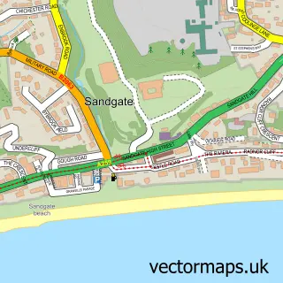
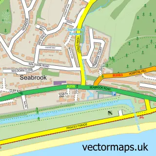
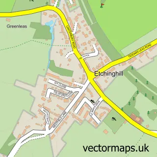
This Folkestone street map is a detailed vector street map covering a 750m x 750m area. Select a larger area to create and download your own vector street map of Folkestone.
The 750-metre map sample for Folkestone covers 224 mapped buildings and approximately 25.3 km of road detail, of which 64 named roads are named. The immediate area includes 3 schools, 1 GP surgery, with 6 within 2 miles, 16 pubs and 1 MOT station, with 16 within 2 miles. The wider area around Folkestone features 10 tourism points of interest, 65 food and drink venues and 9 hotels. To create a larger or custom map of Folkestone, the map builder lets you define your own coverage area and download editable SVG, PDF and PNG files.
Create a larger editable map of Folkestone
Choose any area you need and generate a high-quality vector map instantly. Perfect for print, planning, design, business and personal use.

This Folkestone street map in Kent is available as downloadable SVG, PDF and PNG map files, or as a printed map for planning, business, display, education, local information and design work. You can also create a larger custom map area using the map selector.
What this Folkestone map sample shows
Folkestone lies within Folkestone Cp parish, part of Folkestone Central ward in the Folkestone And Hythe District local authority area. The postcode geography for this area includes the CT postcode area, the CT20 postcode district and the CT20 1 postcode sector. Residents fall under the Nhs Kent And Medway Integrated Care Board for NHS services.
Local features near Folkestone
Within 2 milesAmenities and services in and around Folkestone.
Administrative and postcode information for Folkestone
The local authority covering Folkestone is Folkestone And Hythe District, within the county of Kent. The settlement lies within Folkestone Central ward and Folkestone Cp civil parish. The CT20 postcode district and CT20 1 postcode sector serve the immediate area. NHS provision in the area is delivered through East Kent Hospitals University Nhs Foundation Trust.
Nearby street map samples around Folkestone

More street maps in Kent
750 metre map area coverage
Boundary, postcode and point of interest information for the 750m x 750m rectangle centred on this sample map.
Boundaries containing map centre
Constituency: Folkestone and Hythe Co Const
County: Kent County
District: Folkestone and Hythe District
Icb: NHS Kent and Medway ICB
Parish: Folkestone CP
Police Force: kent
Postcode District: CT20
Postcode Sector: CT20 1
Ward: Folkestone Central Ward
Nearby boundaries intersecting sample
Postcode Sector: CT20 2
Ward: Folkestone Harbour Ward
Postcode coverage
POI category counts
Cafe: 24
Hair Salon: 22
Professional Services: 21
Art Gallery: 19
Flowers And Gifts Shop: 19
Pub: 16
Clothing Store: 15
Real Estate Agent: 14
Restaurant: 14
Barber: 13
Sample points of interest
- Black Pearl Offshore Ltd.
- Folkestone Acupuncture
- Folkestone Adult Education Centre
- Skills Plus Kent
- Davis Davis Design
- Robinsons Studio
- Tranceformation Hypnotherapy
- Googies Restaurant Bar
- St Mary and St Eanswythe
- Petticoat Emporium Folkestone
- Petticoat Emporium Folkestone
- Retrotech
Create a larger editable map of Folkestone
This sample shows only a 750 metre area. To create a larger map of Folkestone, use our map builder to choose your own coverage area, add titles and download editable SVG, PDF and PNG files.
Create a custom map of Folkestone