Vector Maps logo
Home Why it works Popular maps Districts Samples Customizer Create Your Map
VectorMaps.uk
Home Popular maps Districts Samples Customizer Create Your Map Privacy Disclaimer
Home / UK Maps / Lanarkshire / Glenmavis Map

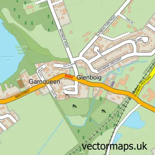
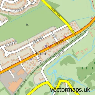
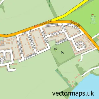
This Glenmavis street map is a detailed vector street map covering a 750m x 750m area. Select a larger area to create and download your own vector street map of Glenmavis.

Glenmavis is a village in Lanarkshire, in the Central Scotland of Scotland. The settlement falls within the Airdrie And Shotts parliamentary constituency. It is served by the ML6 postcode district, with ML6 0 as the local postcode sector.

The 750-metre map sample for Glenmavis covers 291 mapped buildings and approximately 15.8 km of road detail, of which 23 named roads are named. The immediate area includes 5 GP surgeries within 2 miles and 16 MOT stations within 2 miles. To create a larger or custom map of Glenmavis, the map builder lets you define your own coverage area and download editable SVG, PDF and PNG files.

291Buildings
15.76 kmRoads
23Named roads
0Residents within 2 miles
Create your own

Create a larger editable map of Glenmavis

Choose any area you need and generate a high-quality vector map instantly. Perfect for print, planning, design, business and personal use.

Choose any location
Editable SVG files
Any size up to A0
PDF, PNG & more
Instant download
High quality guaranteed
Create My Custom Map
Secure, private & no credit card required
Glenmavis Vector Street Map
750m Sample
Glenmavis vector street map sample showing roads, buildings and local features in a 750 metre preview area
Buy Glenmavis Map Print from £12.95 Buy Glenmavis Digital Map from £6

This Glenmavis street map in Lanarkshire is available as downloadable SVG, PDF and PNG map files, or as a printed map for planning, business, display, education, local information and design work. You can also create a larger custom map area using the map selector.

What this Glenmavis map sample shows

Glenmavis lies within North Lanarkshire parish, part of Airdrie North ward in the North Lanarkshire local authority area. The postcode geography for this area includes the ML postcode area, the ML6 postcode district and the ML6 0 postcode sector. Residents fall under the Lanarkshire for NHS services.

Local features near Glenmavis

Within 2 miles

Amenities and services in and around Glenmavis.

5 GP surgeries within 2 miles
16 MOT stations within 2 miles
1 Healthcare POIs
2 Vehicle services

Counts are approximate and based on publicly available data.

Administrative and postcode information for Glenmavis

Glenmavis lies within North Lanarkshire parish, part of Airdrie North ward in the North Lanarkshire local authority area. The postcode geography for this area includes the ML postcode area, the ML6 postcode district and the ML6 0 postcode sector. Residents fall under the Lanarkshire for NHS services.

Parish NORTH LANARKSHIRE
Ward Airdrie North
District / local authority North Lanarkshire
County Lanarkshire
Historic county Lanarkshire
Postcode district ML6
Postcode sector ML6 0
Parliamentary constituency Airdrie and Shotts
Region Central Scotland
Country Scotland

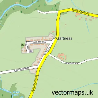
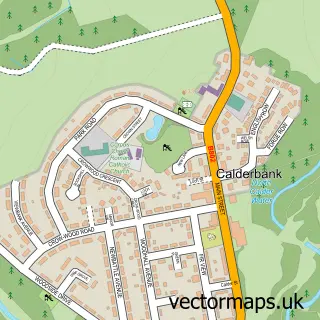
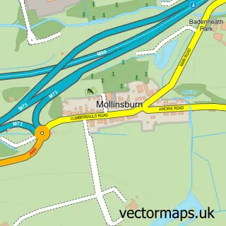
Nearby street map samples around Glenmavis

Street map sample of Airdrie, Lanarkshire Airdrie Town - Lanarkshire - 1.5 miles Street map sample of Glasgow, City of Glasgow Glasgow City - City of Glasgow - 10.0 miles Street map sample of Glenboig, Lanarkshire Glenboig Village - Lanarkshire - 2.0 miles Street map sample of Wattston, Lanarkshire Wattston Village - Lanarkshire - 2.1 miles Street map sample of Greengairs, Lanarkshire Greengairs Village - Lanarkshire - 2.8 miles Street map sample of Plains, Lanarkshire Plains Village - Lanarkshire - 2.8 miles Street map sample of Gartness, Lanarkshire Gartness Village - Lanarkshire - 3.0 miles Street map sample of Calderbank, Lanarkshire Calderbank Village - Lanarkshire - 3.1 miles Street map sample of Mollinsburn, Lanarkshire Mollinsburn Village - Lanarkshire - 3.3 miles Street map sample of Mount Ellen, Lanarkshire Mount Ellen Village - Lanarkshire - 3.7 miles

More street maps in Lanarkshire

Street map sample of Airdrie, Lanarkshire Airdrie Town - 1.5 miles Street map sample of Glenboig, Lanarkshire Glenboig Village - 2.0 miles Street map sample of Coatbridge, Lanarkshire Coatbridge Town - 2.0 miles Street map sample of Wattston, Lanarkshire Wattston Village - 2.1 miles Street map sample of Greengairs, Lanarkshire Greengairs Village - 2.8 miles

750 metre map area coverage

Boundary, postcode and point of interest information for the 750m x 750m rectangle centred on this sample map.

Boundaries containing map centre

Constituency: Airdrie and Shotts Co Const

District: North Lanarkshire

Icb: Lanarkshire

Postcode District: ML6

Postcode Sector: ML6 0

Ward: Airdrie North Ward

Nearby boundaries intersecting sample

No additional intersecting boundaries found.

Postcode coverage

ML6 ML6 0

POI category counts

Beauty And Spa: 3

Automotive Repair: 2

Building Supply Store: 2

Hair Salon: 2

Shipping Center: 2

Arts And Entertainment: 1

Auto Upholstery: 1

Bar: 1

Bed And Breakfast: 1

Builders: 1

Sample points of interest

  • Glenmavis Arts And Entertainment
  • Creative Curtains by Jill Auto Upholstery
  • Kirkstyle Garage Automotive Repair
  • Moseley Distributors Automotive Repair
  • Orange Hall Glenmavis Bar
  • Blend Beauty And Spa
  • Dazzlynn Aesthetics Beauty And Spa
  • Kae Brows Microblading Beauty And Spa
  • Rowan Lodge Bed And Breakfast
  • Start 2 Finish Building Services Builders
  • D Shanks Builders Building Supply Store
  • J B Power Cleaning Building Supply Store

Create a larger editable map of Glenmavis

This sample shows only a 750 metre area. To create a larger map of Glenmavis, use our map builder to choose your own coverage area, add titles and download editable SVG, PDF and PNG files.

Create a custom map of Glenmavis

Phone 01751 473136 | Copyright Vectormaps.uk 2026

Samples Customizer Privacy Disclaimer
Glenmavis Vector Street Map
Glenmavis enlarged street map sample showing a 750 metre preview area