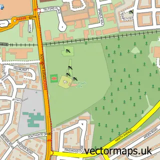
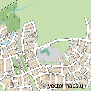
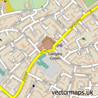
This Gossops Green street map is a detailed vector street map covering a 750m x 750m area. Select a larger area to create and download your own vector street map of Gossops Green.
The 750-metre map sample for Gossops Green covers 368 mapped buildings and approximately 19.1 km of road detail, of which 41 named roads are named. The immediate area includes 1 school, 1 railway station, 9 GP surgeries within 2 miles and 1 pub among other local services. The wider area around Gossops Green features 3 tourism points of interest and 1 food and drink venue. To create a larger or custom map of Gossops Green, the map builder lets you define your own coverage area and download editable SVG, PDF and PNG files.
Create a larger editable map of Gossops Green
Choose any area you need and generate a high-quality vector map instantly. Perfect for print, planning, design, business and personal use.

This Gossops Green street map in West Sussex is available as downloadable SVG, PDF and PNG map files, or as a printed map for planning, business, display, education, local information and design work. You can also create a larger custom map area using the map selector.
What this Gossops Green map sample shows
Gossops Green lies within West Sussex County parish, part of Ifield ward in the Crawley District (B) local authority area. The postcode geography for this area includes the RH postcode area, the RH11 postcode district and the RH11 0 postcode sector. Residents fall under the Nhs Sussex Integrated Care Board for NHS services.
Local features near Gossops Green
Within 2 milesAmenities and services in and around Gossops Green.
Administrative and postcode information for Gossops Green
Gossops Green lies within West Sussex County parish, part of Ifield ward in the Crawley District (B) local authority area. The postcode geography for this area includes the RH postcode area, the RH11 postcode district and the RH11 0 postcode sector. Residents fall under the Nhs Sussex Integrated Care Board for NHS services.
Nearby street map samples around Gossops Green

More street maps in West Sussex
750 metre map area coverage
Boundary, postcode and point of interest information for the 750m x 750m rectangle centred on this sample map.
Boundaries containing map centre
Constituency: Crawley Boro Const
County: West Sussex County
District: Crawley District (B)
Icb: NHS Surrey and Sussex ICB
Police Force: sussex
Postcode District: RH11
Postcode Sector: RH11 8
Ward: Gossops Green & North East Broadfield Ward
Nearby boundaries intersecting sample
Postcode Sector: RH11 0
Ward: Ifield Ward
Postcode coverage
POI category counts
Car Dealer: 3
Youth Organizations: 3
Church Cathedral: 2
Community Center: 2
Contractor: 2
Convenience Store: 2
General Dentistry: 2
Hair Salon: 2
Indian Restaurant: 2
Park: 2
Sample points of interest
- Morrisons Daily - Crawley Gossops Green , Gossops Green
- JCB Fiat Crawley
- Djs custom remaps
- Iza's Hairdressing
- Coral
- BP Builders Crawley Ltd
- OLTiA Books
- UK Door Experts ltd
- Madina Halal Butchers
- Eurovans
- Volkswagen Commercial Vehicles UK
- Wilson Purves
Create a larger editable map of Gossops Green
This sample shows only a 750 metre area. To create a larger map of Gossops Green, use our map builder to choose your own coverage area, add titles and download editable SVG, PDF and PNG files.
Create a custom map of Gossops Green