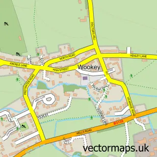
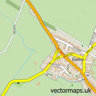
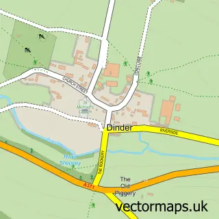
This Haybridge street map is a detailed vector street map covering a 750m x 750m area. Select a larger area to create and download your own vector street map of Haybridge.
The 750-metre map sample for Haybridge covers 177 mapped buildings and approximately 8.1 km of road detail, of which 4 named roads are named. The immediate area includes 2 GP surgeries within 2 miles and 1 MOT station, with 8 within 2 miles. The wider area around Haybridge features 2 tourism points of interest and 1 campsite within 2 miles. To create a larger or custom map of Haybridge, the map builder lets you define your own coverage area and download editable SVG, PDF and PNG files.
Create a larger editable map of Haybridge
Choose any area you need and generate a high-quality vector map instantly. Perfect for print, planning, design, business and personal use.

This Haybridge street map in Somerset is available as downloadable SVG, PDF and PNG map files, or as a printed map for planning, business, display, education, local information and design work. You can also create a larger custom map area using the map selector.
What this Haybridge map sample shows
Haybridge lies within Wookey Cp parish, part of Wookey And St Cuthbert Out West ward in the Somerset local authority area. The postcode geography for this area includes the BA postcode area, the BA5 postcode district and the BA5 1 postcode sector. Residents fall under the Nhs Somerset Integrated Care Board for NHS services.
Local features near Haybridge
Within 2 milesAmenities and services in and around Haybridge.
Administrative and postcode information for Haybridge
The local authority covering Haybridge is Somerset, within the county of Somerset. The settlement lies within Wookey And St Cuthbert Out West ward and Wookey Cp civil parish. The BA5 postcode district and BA5 1 postcode sector serve the immediate area. NHS provision in the area is delivered through Somerset Nhs Foundation Trust.
Nearby street map samples around Haybridge
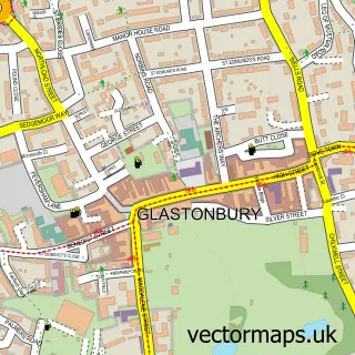

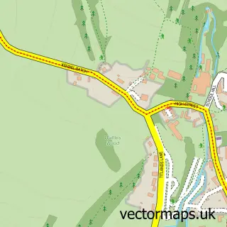
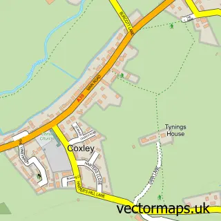
More street maps in Somerset
750 metre map area coverage
Boundary, postcode and point of interest information for the 750m x 750m rectangle centred on this sample map.
Boundaries containing map centre
Constituency: Wells and Mendip Hills Co Const
District: Somerset
Icb: NHS Somerset ICB
Parish: St. Cuthbert Out CP
Police Force: avon and somerset
Postcode District: BA5
Postcode Sector: BA5 1
Nearby boundaries intersecting sample
Parish: Wells CP, Wookey CP
Postcode Sector: BA5 2
Postcode coverage
POI category counts
Automotive Repair: 1
Bakery: 1
Building Supply Store: 1
Campground: 1
It Service And Computer Repair: 1
Landmark And Historical Building: 1
Pet Groomer: 1
Train Station: 1
Travel Agents: 1
Sample points of interest
- Station Motor Services
- Baked By Bridget
- Finch Renovations Ltd
- Wells Touring Park
- Pro Service
- Haybridge
- 4 Paws Dog Grooming
- Wookey railway station
- Wells Touring Park
Create a larger editable map of Haybridge
This sample shows only a 750 metre area. To create a larger map of Haybridge, use our map builder to choose your own coverage area, add titles and download editable SVG, PDF and PNG files.
Create a custom map of Haybridge