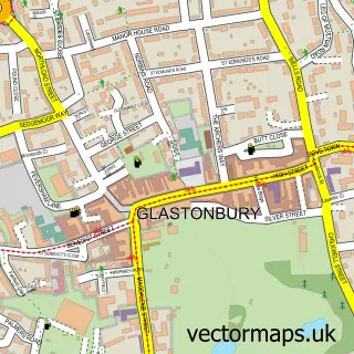
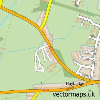
This Easton street map is a detailed vector street map covering a 750m x 750m area. Select a larger area to create and download your own vector street map of Easton.
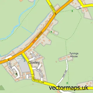
The 750-metre map sample for Easton covers 171 mapped buildings and approximately 11.6 km of road detail, of which 11 named roads are named. The immediate area includes 1 MOT station, with 4 within 2 miles. The wider area around Easton features 1 tourism point of interest, 1 hotel and 2 campsites within 2 miles. To create a larger or custom map of Easton, the map builder lets you define your own coverage area and download editable SVG, PDF and PNG files.
Create a larger editable map of Easton
Choose any area you need and generate a high-quality vector map instantly. Perfect for print, planning, design, business and personal use.

This Easton street map in Somerset is available as downloadable SVG, PDF and PNG map files, or as a printed map for planning, business, display, education, local information and design work. You can also create a larger custom map area using the map selector.
What this Easton map sample shows
Easton lies within St. Cuthbert Out Cp parish, part of St Cuthbert Out North ward in the Somerset local authority area. The postcode geography for this area includes the BA postcode area, the BA5 postcode district and the BA5 1 postcode sector. Residents fall under the Nhs Somerset Integrated Care Board for NHS services.
Local features near Easton
Within 2 milesAmenities and services in and around Easton.
Administrative and postcode information for Easton
Easton lies within St. Cuthbert Out Cp parish, part of St Cuthbert Out North ward in the Somerset local authority area. The postcode geography for this area includes the BA postcode area, the BA5 postcode district and the BA5 1 postcode sector. Residents fall under the Nhs Somerset Integrated Care Board for NHS services.
Nearby street map samples around Easton

More street maps in Somerset
750 metre map area coverage
Boundary, postcode and point of interest information for the 750m x 750m rectangle centred on this sample map.
Boundaries containing map centre
Constituency: Wells and Mendip Hills Co Const
District: Somerset
Icb: NHS Somerset ICB
Parish: St. Cuthbert Out CP
Police Force: avon and somerset
Postcode District: BA5
Postcode Sector: BA5 1
Nearby boundaries intersecting sample
Parish: Westbury CP
Postcode coverage
POI category counts
Gardener: 2
Anglican Church: 1
Contractor: 1
Driving School: 1
Gym: 1
Hotel: 1
Laboratory: 1
Landmark And Historical Building: 1
Metal Supplier: 1
Motorcycle Repair: 1
Sample points of interest
- St Paul
- Gallery Stone Masons
- Phoenix SW Ltd motorcycle training Wells
- Keep It Simple Tree and Garden Care
- Whitebeam Tree Services
- OTS Training
- The Old New Inn On Priddy Green
- Quality Milk Management Services
- Easton
- Somerset Forge
- Somerset Superbikes
- Countrywide Weekends
Create a larger editable map of Easton
This sample shows only a 750 metre area. To create a larger map of Easton, use our map builder to choose your own coverage area, add titles and download editable SVG, PDF and PNG files.
Create a custom map of Easton