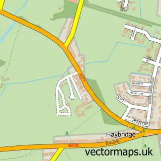
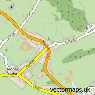
This Wookey street map is a detailed vector street map covering a 750m x 750m area. Select a larger area to create and download your own vector street map of Wookey.
The 750-metre map sample for Wookey covers 221 mapped buildings and approximately 14.7 km of road detail, of which 20 named roads are named. The immediate area includes 2 GP surgeries within 2 miles, 2 pubs and 8 MOT stations within 2 miles. The wider area around Wookey features 3 food and drink venues, 1 hotel and 1 campsite within 2 miles. To create a larger or custom map of Wookey, the map builder lets you define your own coverage area and download editable SVG, PDF and PNG files.
Create a larger editable map of Wookey
Choose any area you need and generate a high-quality vector map instantly. Perfect for print, planning, design, business and personal use.

This Wookey street map in Somerset is available as downloadable SVG, PDF and PNG map files, or as a printed map for planning, business, display, education, local information and design work. You can also create a larger custom map area using the map selector.
What this Wookey map sample shows
Wookey lies within Wookey Cp parish, part of Wookey And St Cuthbert Out West ward in the Somerset local authority area. The postcode geography for this area includes the BA postcode area, the BA5 postcode district and the BA5 1 postcode sector. Residents fall under the Nhs Somerset Integrated Care Board for NHS services.
Local features near Wookey
Within 2 milesAmenities and services in and around Wookey.
Administrative and postcode information for Wookey
The local authority covering Wookey is Somerset, within the county of Somerset. The settlement lies within Wookey And St Cuthbert Out West ward and Wookey Cp civil parish. The BA5 postcode district and BA5 1 postcode sector serve the immediate area. NHS provision in the area is delivered through Somerset Nhs Foundation Trust.
Nearby street map samples around Wookey

More street maps in Somerset
750 metre map area coverage
Boundary, postcode and point of interest information for the 750m x 750m rectangle centred on this sample map.
Boundaries containing map centre
Constituency: Wells and Mendip Hills Co Const
District: Somerset
Icb: NHS Somerset ICB
Parish: Wookey CP
Police Force: avon and somerset
Postcode District: BA5
Postcode Sector: BA5 1
Nearby boundaries intersecting sample
Parish: St. Cuthbert Out CP
Postcode coverage
POI category counts
Anglican Church: 2
Pub: 2
Arts And Entertainment: 1
Assisted Living Facility: 1
Cafe: 1
Community Services Non Profits: 1
Construction Services: 1
Courier And Delivery Services: 1
Driving School: 1
Garbage Collection Service: 1
Sample points of interest
- St Matthew's, Wookey
- St. Matthew's Church
- Gillian Hulse
- East Court Residential Home
- Wookey Hub
- Orchard Vale Trust
- E.A Construction
- P J Parcels Courier & Light Haulage Services
- AA Instructor Dan Hare
- Cheddar & Wells Skips
- Burcott Mill Guesthouse
- Burcott Inn
Create a larger editable map of Wookey
This sample shows only a 750 metre area. To create a larger map of Wookey, use our map builder to choose your own coverage area, add titles and download editable SVG, PDF and PNG files.
Create a custom map of Wookey