Vector Maps logo
Home Why it works Popular maps Districts Samples Customizer Create Your Map
VectorMaps.uk
Home Popular maps Districts Samples Customizer Create Your Map Privacy Disclaimer
Home / UK Maps / Greater Manchester / Hyde Map

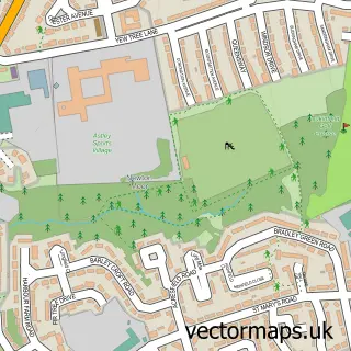
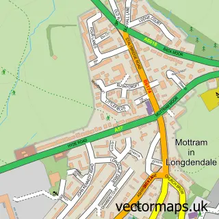
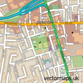
This Hyde street map is a detailed vector street map covering a 750m x 750m area. Select a larger area to create and download your own vector street map of Hyde.

Hyde is a town in Greater Manchester, in the North West of England. Historically, the area formed part of Cheshire. The settlement falls within the Stalybridge And Hyde parliamentary constituency. It is served by the SK14 postcode district, with SK14 4 as

The 750-metre map sample for Hyde covers 262 mapped buildings and approximately 30.9 km of road detail, of which 70 named roads are named. The immediate area includes 1 school, 3 GP surgeries, with 11 within 2 miles, 14 pubs and 2 MOT stations, with 27 within 2 miles. The wider area around Hyde features 1 tourism point of interest and 31 food and drink venues. To create a larger or custom map of Hyde, the map builder lets you define your own coverage area and download editable SVG, PDF and PNG files.

262Buildings
30.91 kmRoads
70Named roads
40,355Residents within 2 miles
Create your own

Create a larger editable map of Hyde

Choose any area you need and generate a high-quality vector map instantly. Perfect for print, planning, design, business and personal use.

Choose any location
Editable SVG files
Any size up to A0
PDF, PNG & more
Instant download
High quality guaranteed
Create My Custom Map
Secure, private & no credit card required
Hyde Vector Street Map
750m Sample
Hyde vector street map sample showing roads, buildings and local features in a 750 metre preview area
Buy Hyde Map Print from £12.95 Buy Hyde Digital Map from £6

This Hyde street map in Greater Manchester is available as downloadable SVG, PDF and PNG map files, or as a printed map for planning, business, display, education, local information and design work. You can also create a larger custom map area using the map selector.

What this Hyde map sample shows

Hyde lies within Tameside District (B) parish, part of Hyde Newton ward in the Tameside District (B) local authority area. The postcode geography for this area includes the SK postcode area, the SK14 postcode district and the SK14 4 postcode sector. Residents fall under the Nhs Greater Manchester Integrated Care Board for NHS services.

Local features near Hyde

Within 2 miles

Amenities and services in and around Hyde.

1 Schools
3 GP surgeries 11 within 2 miles
2 MOT stations 27 within 2 miles
1 Tourism & leisure
31 Food & drink
14 Pubs
11 Healthcare POIs
7 Vehicle services

Counts are approximate and based on publicly available data.

Administrative and postcode information for Hyde

Hyde lies within Tameside District (B) parish, part of Hyde Newton ward in the Tameside District (B) local authority area. The postcode geography for this area includes the SK postcode area, the SK14 postcode district and the SK14 4 postcode sector. Residents fall under the Nhs Greater Manchester Integrated Care Board for NHS services.

Parish TAMESIDE DISTRICT (B)
Ward Hyde Newton
District / local authority Tameside District (B)
County Greater Manchester
Historic county Cheshire
Postcode district SK14
Postcode sector SK14 4
Parliamentary constituency Stalybridge and Hyde
Region North West
Country England

Nearby street map samples around Hyde

Street map sample of Manchester, Greater Manchester Manchester City - Greater Manchester - 7.1 miles Street map sample of Newtonmoor, Greater Manchester Newtonmoor Village - Greater Manchester - 1.2 miles Street map sample of Haughton Green, Greater Manchester Haughton Green Village - Greater Manchester - 1.3 miles Street map sample of Hattersley, Greater Manchester Hattersley Village - Greater Manchester - 2.1 miles Street map sample of Broadbottom, Greater Manchester Broadbottom Village - Greater Manchester - 2.6 miles Street map sample of Compstall, Greater Manchester Compstall Village - Greater Manchester - 2.6 miles Street map sample of Mottram, Greater Manchester Mottram Village - Greater Manchester - 2.7 miles Street map sample of Millbrook, Greater Manchester Millbrook Village - Greater Manchester - 3.4 miles Street map sample of Higher Chisworth, Derbyshire Higher Chisworth Village - Derbyshire - 3.6 miles Street map sample of Marple Bridge, Greater Manchester Marple Bridge Village - Greater Manchester - 3.6 miles

More street maps in Greater Manchester

Street map sample of Newtonmoor, Greater Manchester Newtonmoor Village - 1.2 miles Street map sample of Haughton Green, Greater Manchester Haughton Green Village - 1.3 miles Street map sample of Denton, Greater Manchester Denton Town - 1.5 miles Street map sample of Dukinfield, Greater Manchester Dukinfield Town - 1.8 miles Street map sample of Hattersley, Greater Manchester Hattersley Village - 2.1 miles

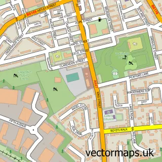
750 metre map area coverage

Boundary, postcode and point of interest information for the 750m x 750m rectangle centred on this sample map.

Boundaries containing map centre

Constituency: Stalybridge and Hyde Co Const

District: Tameside District (B)

Icb: NHS Greater Manchester ICB

Police Force: greater manchester

Postcode District: SK14

Postcode Sector: SK14 2

Ward: Hyde Godley Ward

Nearby boundaries intersecting sample

Postcode Sector: SK14 1, SK14 4

Ward: Hyde Newton Ward, Hyde Werneth Ward

Postcode coverage

SK14 SK14 2 SK14 1 SK14 4

POI category counts

Hair Salon: 25

Beauty Salon: 19

Pub: 14

Fast Food Restaurant: 11

Beauty And Spa: 10

Professional Services: 9

Charity Organization: 8

Indian Restaurant: 8

Cafe: 7

Discount Store: 7

Sample points of interest

  • Tameside Metropolitan Borough Council Fostering Unit Accommodation
  • Accountancy 4 You Accountant
  • Allen Mills Howard & Co. Accountant
  • in2wrk Hyde Adult Education
  • Add Smart Online Marketing Advertising Agency
  • Artwork Design Advertising Agency
  • Delux Travels Airport Shuttles
  • Willow Wood Antique Store
  • MG Domestic Appliance Store
  • Oakland Domestic Appliances Appliance Store
  • VAC Services Appliance Store
  • Abbey Picture Framing Arts And Crafts

Create a larger editable map of Hyde

This sample shows only a 750 metre area. To create a larger map of Hyde, use our map builder to choose your own coverage area, add titles and download editable SVG, PDF and PNG files.

Create a custom map of Hyde

Phone 01751 473136 | Copyright Vectormaps.uk 2026

Samples Customizer Privacy Disclaimer
Hyde Vector Street Map
Hyde enlarged street map sample showing a 750 metre preview area