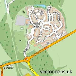
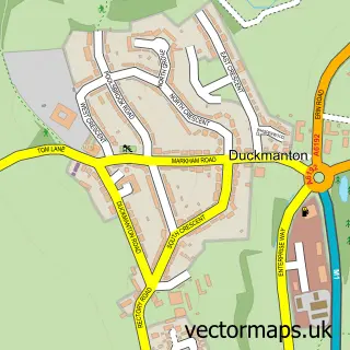
This Inkersall Green street map is a detailed vector street map covering a 750m x 750m area. Select a larger area to create and download your own vector street map of Inkersall Green.
The 750-metre map sample for Inkersall Green covers 596 mapped buildings and approximately 31.5 km of road detail, of which 47 named roads are named. The immediate area includes 1 school, 2 GP surgeries within 2 miles, 2 pubs and 12 MOT stations within 2 miles. The wider area around Inkersall Green features 2 food and drink venues and 1 hotel. To create a larger or custom map of Inkersall Green, the map builder lets you define your own coverage area and download editable SVG, PDF and PNG files.
Create a larger editable map of Inkersall Green
Choose any area you need and generate a high-quality vector map instantly. Perfect for print, planning, design, business and personal use.

This Inkersall Green street map in Derbyshire is available as downloadable SVG, PDF and PNG map files, or as a printed map for planning, business, display, education, local information and design work. You can also create a larger custom map area using the map selector.
What this Inkersall Green map sample shows
Inkersall Green lies within Staveley Cp parish, part of Hollingwood And Inkersall ward in the Chesterfield District (B) local authority area. The postcode geography for this area includes the S postcode area, the S43 postcode district and the S43 2 postcode sector. Residents fall under the Nhs Derby And Derbyshire Integrated Care Board for NHS services.
Local features near Inkersall Green
Within 2 milesAmenities and services in and around Inkersall Green.
Administrative and postcode information for Inkersall Green
Inkersall Green lies within Staveley Cp parish, part of Hollingwood And Inkersall ward in the Chesterfield District (B) local authority area. The postcode geography for this area includes the S postcode area, the S43 postcode district and the S43 2 postcode sector. Residents fall under the Nhs Derby And Derbyshire Integrated Care Board for NHS services.
Nearby street map samples around Inkersall Green


More street maps in Derbyshire
750 metre map area coverage
Boundary, postcode and point of interest information for the 750m x 750m rectangle centred on this sample map.
Boundaries containing map centre
Constituency: Chesterfield Boro Const
County: Derbyshire County
District: Chesterfield District (B)
Icb: NHS Derby and Derbyshire ICB
Parish: Staveley CP
Police Force: derbyshire
Postcode District: S43
Postcode Sector: S43 3
Ward: Staveley South Ward
Nearby boundaries intersecting sample
Ward: Staveley Central Ward
Postcode coverage
POI category counts
Convenience Store: 4
Building Supply Store: 3
Pizza Restaurant: 2
Pub: 2
Advertising Agency: 1
Appliance Repair Service: 1
Appliance Store: 1
Atms: 1
Auto Electrical Repair: 1
Bakery: 1
Sample points of interest
- Gallagher Design
- DARS Domestic Appliance Repair Service
- Domestic Appliance Repair Service
- Select And Save Chesterfield, Inkersall
- Mech Elec Engineering
- Maria's Cakes By Design
- Booker Gin Bar
- SANA by Kayleigh Valeiša
- Dream Decor & Property Maintenance
- Marc Whitley Painting & Decorating Services
- W Atkin Decorator
- Totally Wired
Create a larger editable map of Inkersall Green
This sample shows only a 750 metre area. To create a larger map of Inkersall Green, use our map builder to choose your own coverage area, add titles and download editable SVG, PDF and PNG files.
Create a custom map of Inkersall Green