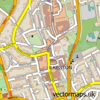
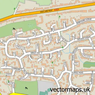
This Kirk Hallam street map is a detailed vector street map covering a 750m x 750m area. Select a larger area to create and download your own vector street map of Kirk Hallam.
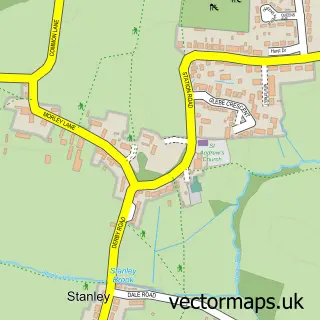
The 750-metre map sample for Kirk Hallam covers 637 mapped buildings and approximately 33.5 km of road detail, of which 40 named roads are named. The immediate area includes 1 school, 6 GP surgeries within 2 miles, 1 pub and 14 MOT stations within 2 miles. The wider area around Kirk Hallam features 2 food and drink venues. To create a larger or custom map of Kirk Hallam, the map builder lets you define your own coverage area and download editable SVG, PDF and PNG files.
Create a larger editable map of Kirk Hallam
Choose any area you need and generate a high-quality vector map instantly. Perfect for print, planning, design, business and personal use.

This Kirk Hallam street map in Derbyshire is available as downloadable SVG, PDF and PNG map files, or as a printed map for planning, business, display, education, local information and design work. You can also create a larger custom map area using the map selector.
What this Kirk Hallam map sample shows
Kirk Hallam lies within Derbyshire County parish, part of Larklands ward in the Erewash District (B) local authority area. The postcode geography for this area includes the DE postcode area, the DE7 postcode district and the DE7 5 postcode sector. Residents fall under the Nhs Derby And Derbyshire Integrated Care Board for NHS services.
Local features near Kirk Hallam
Within 2 milesAmenities and services in and around Kirk Hallam.
Administrative and postcode information for Kirk Hallam
Kirk Hallam lies within Derbyshire County parish, part of Larklands ward in the Erewash District (B) local authority area. The postcode geography for this area includes the DE postcode area, the DE7 postcode district and the DE7 5 postcode sector. Residents fall under the Nhs Derby And Derbyshire Integrated Care Board for NHS services.
Nearby street map samples around Kirk Hallam

More street maps in Derbyshire
750 metre map area coverage
Boundary, postcode and point of interest information for the 750m x 750m rectangle centred on this sample map.
Boundaries containing map centre
Constituency: Erewash Co Const
County: Derbyshire County
District: Erewash District (B)
Icb: NHS Derby and Derbyshire ICB
Police Force: derbyshire
Postcode District: DE7
Postcode Sector: DE7 4
Ward: Kirk Hallam & Stanton-by-Dale Ward
Nearby boundaries intersecting sample
No additional intersecting boundaries found.
Postcode coverage
POI category counts
Dentist: 5
Convenience Store: 4
Building Supply Store: 2
Electrician: 2
Elementary School: 2
Hair Salon: 2
Post Office: 2
Rental Kiosks: 2
Advertising Agency: 1
Architectural Designer: 1
Sample points of interest
- GetBranded
- Hampton Booth
- Me 2 You Personalised Gifts
- Kirk Hallam
- Carglaze
- kimboscakes
- Polished
- Reflections
- Hughes Beer Garden
- Bizzy Bees
- The Garden Rangers
- Kirk Hallam Co-op.
Create a larger editable map of Kirk Hallam
This sample shows only a 750 metre area. To create a larger map of Kirk Hallam, use our map builder to choose your own coverage area, add titles and download editable SVG, PDF and PNG files.
Create a custom map of Kirk Hallam