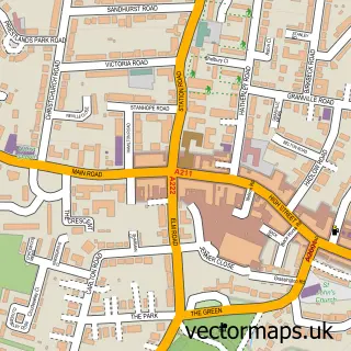
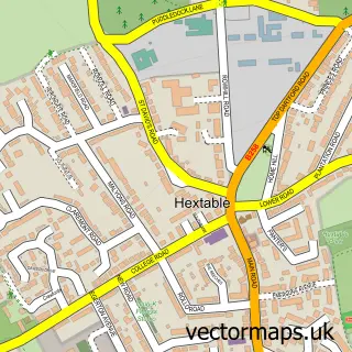
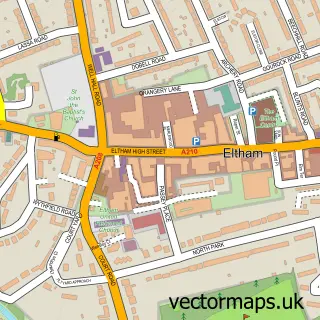
This Lamorbey street map is a detailed vector street map covering a 750m x 750m area. Select a larger area to create and download your own vector street map of Lamorbey.
The 750-metre map sample for Lamorbey covers 295 mapped buildings and approximately 14.2 km of road detail, of which 27 named roads are named. The immediate area includes 2 schools, 1 railway station, 11 GP surgeries within 2 miles and 5 pubs among other local services. The wider area around Lamorbey features 4 tourism points of interest, 15 food and drink venues and 1 hotel. To create a larger or custom map of Lamorbey, the map builder lets you define your own coverage area and download editable SVG, PDF and PNG files.
Create a larger editable map of Lamorbey
Choose any area you need and generate a high-quality vector map instantly. Perfect for print, planning, design, business and personal use.

This Lamorbey street map in Greater London is available as downloadable SVG, PDF and PNG map files, or as a printed map for planning, business, display, education, local information and design work. You can also create a larger custom map area using the map selector.
What this Lamorbey map sample shows
Lamorbey lies within Greater London Authority parish, part of Sidcup ward in the Bexley London Boro local authority area. The postcode geography for this area includes the DA postcode area, the DA15 postcode district and the DA15 7 postcode sector. Residents fall under the Nhs South East London Integrated Care Board for NHS services.
Local features near Lamorbey
Within 2 milesAmenities and services in and around Lamorbey.
Administrative and postcode information for Lamorbey
Lamorbey lies within Greater London Authority parish, part of Sidcup ward in the Bexley London Boro local authority area. The postcode geography for this area includes the DA postcode area, the DA15 postcode district and the DA15 7 postcode sector. Residents fall under the Nhs South East London Integrated Care Board for NHS services.
Nearby street map samples around Lamorbey


More street maps in Greater London
750 metre map area coverage
Boundary, postcode and point of interest information for the 750m x 750m rectangle centred on this sample map.
Boundaries containing map centre
Constituency: Old Bexley and Sidcup Boro Const
County: Greater London Authority
District: Bexley London Boro
Icb: NHS South East London ICB
Police Force: metropolitan
Postcode District: DA15
Postcode Sector: DA15 7
Ward: Blackfen & Lamorbey Ward
Nearby boundaries intersecting sample
Postcode District: DA14
Postcode Sector: DA14 4, DA15 8, DA15 9
Ward: Blendon & Penhill Ward, Longlands Ward, Sidcup Ward
Postcode coverage
POI category counts
Hair Salon: 6
Professional Services: 6
Building Supply Store: 5
Coffee Shop: 5
Pub: 5
Real Estate Agent: 5
Gym: 4
Property Management: 4
Barber: 3
Church Cathedral: 3
Sample points of interest
- MKS Accountants Limited
- Lamorbey Travel
- Holy Trinity Lamorbey, Sidcup
- Fold Designs
- The Seasons Art Class Sidcup and Chislehurst
- PayPoint
- Sidcup Station - London & South Eastern Railway
- King George Playing Fields
- RW Crash Repairs
- UKFCS Mortgage Specialists
- Whiter Financial
- M P Motors
Create a larger editable map of Lamorbey
This sample shows only a 750 metre area. To create a larger map of Lamorbey, use our map builder to choose your own coverage area, add titles and download editable SVG, PDF and PNG files.
Create a custom map of Lamorbey