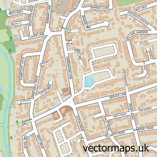
This Lancing street map is a detailed vector street map covering a 750m x 750m area. Select a larger area to create and download your own vector street map of Lancing.
The 750-metre map sample for Lancing covers 649 mapped buildings and approximately 22.0 km of road detail, of which 41 named roads are named. The immediate area includes 1 school, 1 railway station, 2 GP surgeries, with 4 within 2 miles and 6 pubs among other local services. The wider area around Lancing features 11 food and drink venues, 1 hotel and 1 campsite within 2 miles. To create a larger or custom map of Lancing, the map builder lets you define your own coverage area and download editable SVG, PDF and PNG files.
Create a larger editable map of Lancing
Choose any area you need and generate a high-quality vector map instantly. Perfect for print, planning, design, business and personal use.

This Lancing street map in West Sussex is available as downloadable SVG, PDF and PNG map files, or as a printed map for planning, business, display, education, local information and design work. You can also create a larger custom map area using the map selector.
What this Lancing map sample shows
Lancing lies within Lancing Cp parish, part of Mash Barn ward in the Adur District local authority area. The postcode geography for this area includes the BN postcode area, the BN15 postcode district and the BN15 9 postcode sector. Residents fall under the Nhs Sussex Integrated Care Board for NHS services.
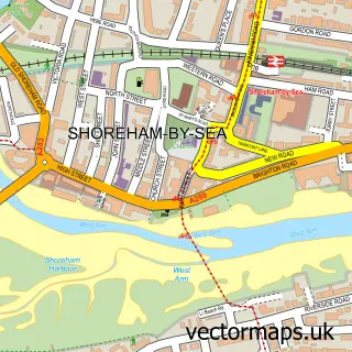
Local features near Lancing
Within 2 milesAmenities and services in and around Lancing.
Administrative and postcode information for Lancing
Lancing lies within Lancing Cp parish, part of Mash Barn ward in the Adur District local authority area. The postcode geography for this area includes the BN postcode area, the BN15 postcode district and the BN15 9 postcode sector. Residents fall under the Nhs Sussex Integrated Care Board for NHS services.
Nearby street map samples around Lancing

More street maps in West Sussex
750 metre map area coverage
Boundary, postcode and point of interest information for the 750m x 750m rectangle centred on this sample map.
Boundaries containing map centre
Constituency: East Worthing and Shoreham Co Const
County: West Sussex County
District: Adur District
Icb: NHS Surrey and Sussex ICB
Parish: Lancing CP
Police Force: sussex
Postcode District: BN15
Postcode Sector: BN15 8
Ward: Widewater Ward
Nearby boundaries intersecting sample
Postcode Sector: BN15 9
Ward: Churchill Ward, Mash Barn Ward
Postcode coverage
POI category counts
Real Estate Agent: 7
Beauty Salon: 6
Chinese Restaurant: 6
Pub: 6
Barber: 5
Building Supply Store: 5
Carpet Store: 4
Community Services Non Profits: 4
Doctor: 4
Funeral Services And Cemeteries: 4
Sample points of interest
- Till and Cloake
- Lancing Surf Lodge
- Business Growth Co
- Henley & Burton Business Machines
- Italian Restaurant & Pizzeria O' Curniciello
- St Michael and All Angels Church
- Lancing & Sompting Lions
- St Barnabas
- Dyson Repairs Brighton
- BSB Party Wall and Architectural Services
- Tara Signs Ltd
- Wear Your Logo
Create a larger editable map of Lancing
This sample shows only a 750 metre area. To create a larger map of Lancing, use our map builder to choose your own coverage area, add titles and download editable SVG, PDF and PNG files.
Create a custom map of Lancing