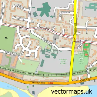
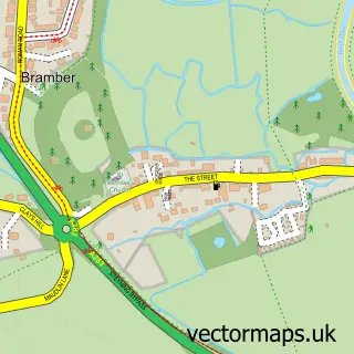
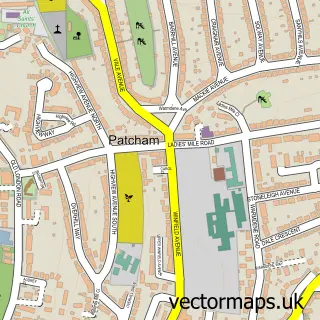
This Shoreham-by-Sea street map is a detailed vector street map covering a 750m x 750m area. Select a larger area to create and download your own vector street map of Shoreham-by-Sea.
The 750-metre map sample for Shoreham-by-Sea covers 236 mapped buildings and approximately 18.4 km of road detail, of which 41 named roads are named. The immediate area includes 1 school, 1 railway station, 1 GP surgery and 16 pubs among other local services. The wider area around Shoreham-by-Sea features 5 tourism points of interest, 38 food and drink venues and 1 campsite within 2 miles. To create a larger or custom map of Shoreham-by-Sea, the map builder lets you define your own coverage area and download editable SVG, PDF and PNG files.
Create a larger editable map of Shoreham-by-Sea
Choose any area you need and generate a high-quality vector map instantly. Perfect for print, planning, design, business and personal use.

This Shoreham-by-Sea street map in West Sussex is available as downloadable SVG, PDF and PNG map files, or as a printed map for planning, business, display, education, local information and design work. You can also create a larger custom map area using the map selector.
What this Shoreham-by-Sea map sample shows
Shoreham-by-Sea lies within West Sussex County parish, part of St Mary's ward in the Adur District local authority area. The postcode geography for this area includes the BN postcode area, the BN43 postcode district and the BN43 5 postcode sector. Residents fall under the Nhs Sussex Integrated Care Board for NHS services.
Local features near Shoreham-by-Sea
Within 2 milesAmenities and services in and around Shoreham-by-Sea.
Administrative and postcode information for Shoreham-by-Sea
Shoreham-by-Sea lies within West Sussex County parish, part of St Mary's ward in the Adur District local authority area. The postcode geography for this area includes the BN postcode area, the BN43 postcode district and the BN43 5 postcode sector. Residents fall under the Nhs Sussex Integrated Care Board for NHS services.
Nearby street map samples around Shoreham-by-Sea

More street maps in West Sussex
750 metre map area coverage
Boundary, postcode and point of interest information for the 750m x 750m rectangle centred on this sample map.
Boundaries containing map centre
Constituency: East Worthing and Shoreham Co Const
County: West Sussex County
District: Adur District
Icb: NHS Surrey and Sussex ICB
Police Force: sussex
Postcode District: BN43
Postcode Sector: BN43 5
Ward: St. Mary's Ward
Nearby boundaries intersecting sample
Postcode Sector: BN43 6
Ward: Marine Ward, St. Nicolas Ward
Postcode coverage
POI category counts
Pub: 16
Beauty Salon: 13
Professional Services: 13
Hair Salon: 12
Barber: 9
Church Cathedral: 9
Advertising Agency: 8
Cafe: 8
Coffee Shop: 8
Real Estate Agent: 8
Sample points of interest
- Addiction Link
- Cloud Concepts Accounting
- Flint Accounting Limited
- R2 Finance
- The Helpful Bookkeeper
- Adur Acupuncture
- Face Facts Natural Health & Beauty
- Leona Andersson Acupuncture
- Leona Andersson Acupuncture
- Day 1 Communications
- KES Distribution & Social Media Services
- Nettl of Hove
Create a larger editable map of Shoreham-by-Sea
This sample shows only a 750 metre area. To create a larger map of Shoreham-by-Sea, use our map builder to choose your own coverage area, add titles and download editable SVG, PDF and PNG files.
Create a custom map of Shoreham-by-Sea