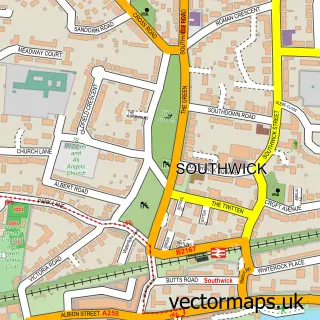
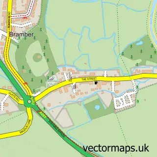
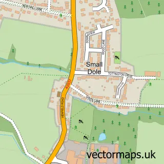
This Kingston Buci street map is a detailed vector street map covering a 750m x 750m area. Select a larger area to create and download your own vector street map of Kingston Buci.
The 750-metre map sample for Kingston Buci covers 306 mapped buildings and approximately 14.9 km of road detail, of which 23 named roads are named. The immediate area includes 2 schools, 4 GP surgeries within 2 miles and 2 MOT stations, with 27 within 2 miles. To create a larger or custom map of Kingston Buci, the map builder lets you define your own coverage area and download editable SVG, PDF and PNG files.
Create a larger editable map of Kingston Buci
Choose any area you need and generate a high-quality vector map instantly. Perfect for print, planning, design, business and personal use.

This Kingston Buci street map in West Sussex is available as downloadable SVG, PDF and PNG map files, or as a printed map for planning, business, display, education, local information and design work. You can also create a larger custom map area using the map selector.
What this Kingston Buci map sample shows
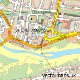
Kingston Buci lies within West Sussex County parish, part of Southwick Green ward in the Adur District local authority area. The postcode geography for this area includes the BN postcode area, the BN42 postcode district and the BN42 4 postcode sector. Residents fall under the Nhs Sussex Integrated Care Board for NHS services.
Local features near Kingston Buci
Within 2 milesAmenities and services in and around Kingston Buci.
Administrative and postcode information for Kingston Buci
Kingston Buci lies within West Sussex County parish, part of Southwick Green ward in the Adur District local authority area. The postcode geography for this area includes the BN postcode area, the BN42 postcode district and the BN42 4 postcode sector. Residents fall under the Nhs Sussex Integrated Care Board for NHS services.
Nearby street map samples around Kingston Buci

More street maps in West Sussex
750 metre map area coverage
Boundary, postcode and point of interest information for the 750m x 750m rectangle centred on this sample map.
Boundaries containing map centre
Constituency: East Worthing and Shoreham Co Const
County: West Sussex County
District: Adur District
Icb: NHS Surrey and Sussex ICB
Police Force: sussex
Postcode District: BN43
Postcode Sector: BN43 6
Ward: Southwick Green Ward
Nearby boundaries intersecting sample
Postcode District: BN42
Postcode Sector: BN42 4, BN43 5
Ward: Marine Ward, Southlands Ward, St. Mary's Ward
Postcode coverage
POI category counts
Used Car Dealer: 3
Beauty Salon: 2
Bed And Breakfast: 2
Building Supply Store: 2
Contractor: 2
Day Care Preschool: 2
Lighthouse: 2
Sports Club And League: 2
Active Life: 1
Advertising Agency: 1
Sample points of interest
- Sussex Marine Water Sports
- St Julian’s Hall Co-Working Space
- Ann O'Keife
- Amgram
- Aliport Commercial
- Bart's Shine Detailing
- Montgomery Motors Ltd
- Car Busters
- Kingston Beach
- Avenue beauty
- Beautybarn Shoreham
- The Anchorage Bed and Breakfast
Create a larger editable map of Kingston Buci
This sample shows only a 750 metre area. To create a larger map of Kingston Buci, use our map builder to choose your own coverage area, add titles and download editable SVG, PDF and PNG files.
Create a custom map of Kingston Buci