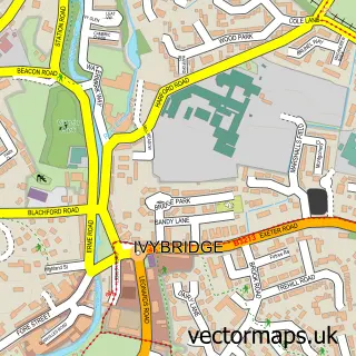
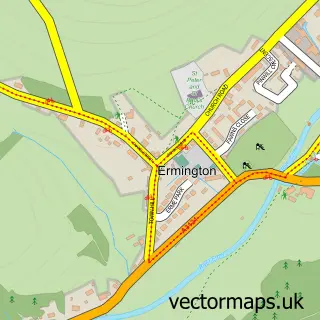
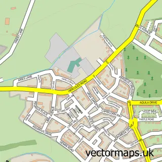
This Lee Mill street map is a detailed vector street map covering a 750m x 750m area. Select a larger area to create and download your own vector street map of Lee Mill.
The 750-metre map sample for Lee Mill covers 112 mapped buildings and approximately 11.0 km of road detail, of which 6 named roads are named. The immediate area includes 1 MOT station, with 3 within 2 miles. The wider area around Lee Mill features 1 tourism point of interest and 1 food and drink venue. To create a larger or custom map of Lee Mill, the map builder lets you define your own coverage area and download editable SVG, PDF and PNG files.
Create a larger editable map of Lee Mill
Choose any area you need and generate a high-quality vector map instantly. Perfect for print, planning, design, business and personal use.

This Lee Mill street map in Devon is available as downloadable SVG, PDF and PNG map files, or as a printed map for planning, business, display, education, local information and design work. You can also create a larger custom map area using the map selector.
What this Lee Mill map sample shows
Lee Mill lies within Ermington Cp parish, part of Ermington & Ugborough ward in the South Hams District local authority area. The postcode geography for this area includes the PL postcode area, the PL21 postcode district and the PL21 9 postcode sector. Residents fall under the Nhs Devon Integrated Care Board for NHS services.
Local features near Lee Mill
Within 2 milesAmenities and services in and around Lee Mill.
Administrative and postcode information for Lee Mill
Lee Mill lies within Ermington Cp parish, part of Ermington & Ugborough ward in the South Hams District local authority area. The postcode geography for this area includes the PL postcode area, the PL21 postcode district and the PL21 9 postcode sector. Residents fall under the Nhs Devon Integrated Care Board for NHS services.
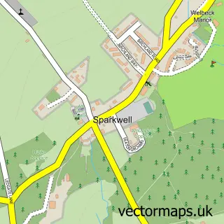
Nearby street map samples around Lee Mill

More street maps in Devon
750 metre map area coverage
Boundary, postcode and point of interest information for the 750m x 750m rectangle centred on this sample map.
Boundaries containing map centre
Constituency: South West Devon Co Const
County: Devon County
District: South Hams District
Icb: NHS Devon ICB
Parish: Sparkwell CP
Police Force: devon and cornwall
Postcode District: PL21
Postcode Sector: PL21 9
Ward: Newton & Yealmpton Ward
Nearby boundaries intersecting sample
Parish: Ermington CP
Postcode District: PL7
Postcode Sector: PL7 5
Ward: Ermington & Ugborough Ward
Postcode coverage
POI category counts
Gas Station: 3
Advertising Agency: 2
Automotive Services And Repair: 2
Hardware Store: 2
Accountant: 1
Automotive Repair: 1
Beauty Salon: 1
Business Manufacturing And Supply: 1
Cafe: 1
Career Counseling: 1
Sample points of interest
- Diamond Bookkeeping and Accounts
- Kioo Marketing
- Om Design & Print
- Euroservice
- Call Care Systems
- Euroservice
- Galina Shchirba mua/hairstylist Plymouth
- Divine Door & Gate Automation
- Westward Cafe
- ML Therapy & Counselling
- Edinburgh Woollen Mill
- Ivy Cottage Counselling
Create a larger editable map of Lee Mill
This sample shows only a 750 metre area. To create a larger map of Lee Mill, use our map builder to choose your own coverage area, add titles and download editable SVG, PDF and PNG files.
Create a custom map of Lee Mill