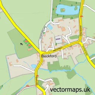
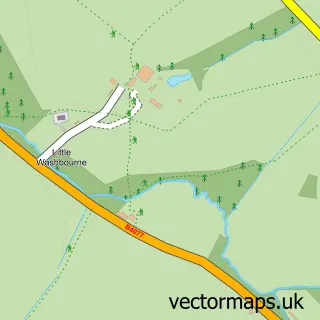
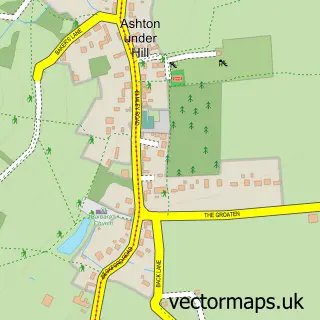
This Little Beckford street map is a detailed vector street map covering a 750m x 750m area. Select a larger area to create and download your own vector street map of Little Beckford.
The 750-metre map sample for Little Beckford covers 103 mapped buildings and approximately 19.5 km of road detail, of which 7 named roads are named. The immediate area includes 1 MOT station within 2 miles. The wider area around Little Beckford features 1 tourism point of interest. To create a larger or custom map of Little Beckford, the map builder lets you define your own coverage area and download editable SVG, PDF and PNG files.
Create a larger editable map of Little Beckford
Choose any area you need and generate a high-quality vector map instantly. Perfect for print, planning, design, business and personal use.

This Little Beckford street map in Worcestershire is available as downloadable SVG, PDF and PNG map files, or as a printed map for planning, business, display, education, local information and design work. You can also create a larger custom map area using the map selector.
What this Little Beckford map sample shows
Little Beckford lies within Beckford Cp parish, part of South Bredon Hill ward in the Wychavon District local authority area. The postcode geography for this area includes the GL postcode area, the GL20 postcode district and the GL20 7 postcode sector. Residents fall under the Nhs Herefordshire And Worcestershire Integrated Care Board for NHS services.
Local features near Little Beckford
Within 2 milesAmenities and services in and around Little Beckford.
Administrative and postcode information for Little Beckford
The local authority covering Little Beckford is Wychavon District, within the county of Worcestershire. The settlement lies within South Bredon Hill ward and Beckford Cp civil parish. The GL20 postcode district and GL20 7 postcode sector serve the immediate area. NHS provision in the area is delivered through Gloucestershire Hospitals Nhs Foundation Trust.
Nearby street map samples around Little Beckford
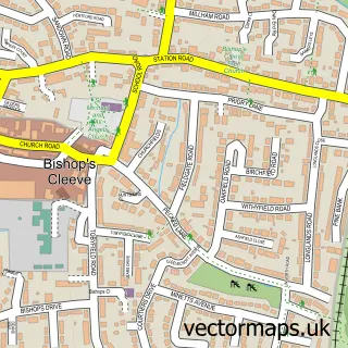

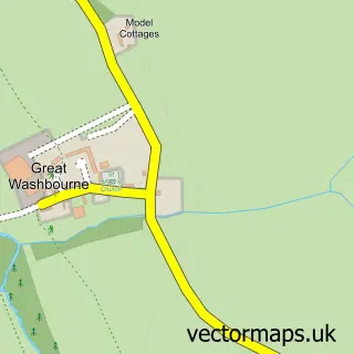
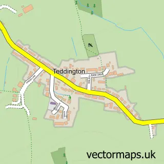
More street maps in Worcestershire
750 metre map area coverage
Boundary, postcode and point of interest information for the 750m x 750m rectangle centred on this sample map.
Boundaries containing map centre
Constituency: West Worcestershire Co Const
County: Worcestershire County
District: Wychavon District
Icb: NHS Herefordshire and Worcestershire ICB
Parish: Beckford CP
Police Force: west mercia
Postcode District: GL20
Postcode Sector: GL20 7
Ward: Bredon Hill Ward
Nearby boundaries intersecting sample
Constituency: Tewkesbury Co Const
County: Gloucestershire County
District: Tewkesbury District (B)
Icb: NHS Gloucestershire ICB
Parish: Dumbleton CP
Police Force: gloucestershire
Ward: Isbourne Ward
Postcode coverage
POI category counts
Bed And Breakfast: 1
Contractor: 1
Grocery Store: 1
Laundry Services: 1
Mobile Phone Store: 1
Museum: 1
Roofing: 1
Telecommunications: 1
Window Treatment Store: 1
Sample points of interest
- The Beckford Inn
- Select Building Solutions
- Wędliny wiejskie Szwagra
- Cotswold Ironing Services
- One Stop Communications
- Little Beckford
- CET Plumbing & Heating Services
- Easi-Tel Ltd.
- Lorna Jane Interiors
Create a larger editable map of Little Beckford
This sample shows only a 750 metre area. To create a larger map of Little Beckford, use our map builder to choose your own coverage area, add titles and download editable SVG, PDF and PNG files.
Create a custom map of Little Beckford