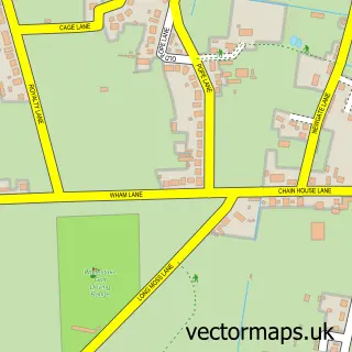
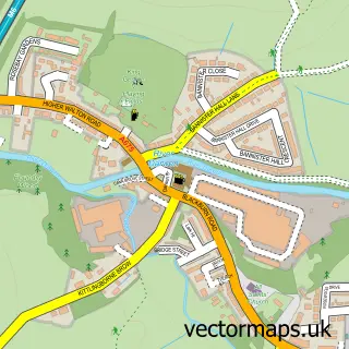
This Lostock Hall street map is a detailed vector street map covering a 750m x 750m area. Select a larger area to create and download your own vector street map of Lostock Hall.
The 750-metre map sample for Lostock Hall covers 584 mapped buildings and approximately 17.6 km of road detail, of which 47 named roads are named. The immediate area includes 2 schools, 1 railway station, 1 GP surgery, with 5 within 2 miles and 7 pubs among other local services. The wider area around Lostock Hall features 2 tourism points of interest and 10 food and drink venues. To create a larger or custom map of Lostock Hall, the map builder lets you define your own coverage area and download editable SVG, PDF and PNG files.
Create a larger editable map of Lostock Hall
Choose any area you need and generate a high-quality vector map instantly. Perfect for print, planning, design, business and personal use.

This Lostock Hall street map in Lancashire is available as downloadable SVG, PDF and PNG map files, or as a printed map for planning, business, display, education, local information and design work. You can also create a larger custom map area using the map selector.
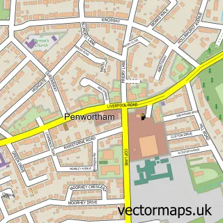
What this Lostock Hall map sample shows
Lostock Hall lies within Farington Cp parish, part of Farington West ward in the South Ribble District (B) local authority area. The postcode geography for this area includes the PR postcode area, the PR26 postcode district and the PR26 6 postcode sector. Residents fall under the Nhs Lancashire And South Cumbria Integrated Care Board for NHS services.
Local features near Lostock Hall
Within 2 milesAmenities and services in and around Lostock Hall.
Administrative and postcode information for Lostock Hall
Lostock Hall lies within Farington Cp parish, part of Farington West ward in the South Ribble District (B) local authority area. The postcode geography for this area includes the PR postcode area, the PR26 postcode district and the PR26 6 postcode sector. Residents fall under the Nhs Lancashire And South Cumbria Integrated Care Board for NHS services.
Nearby street map samples around Lostock Hall

More street maps in Lancashire
750 metre map area coverage
Boundary, postcode and point of interest information for the 750m x 750m rectangle centred on this sample map.
Boundaries containing map centre
Constituency: Ribble Valley Co Const
County: Lancashire County
District: South Ribble District (B)
Icb: NHS Lancashire and South Cumbria ICB
Police Force: lancashire
Postcode District: PR5
Postcode Sector: PR5 5
Nearby boundaries intersecting sample
Constituency: South Ribble Co Const
Parish: Farington CP, Penwortham CP
Postcode District: PR1
Postcode Sector: PR1 9
Ward: Charnock Ward, Farington West Ward, Lostock Hall Ward
Postcode coverage
POI category counts
Hair Salon: 7
Pub: 7
Barber: 6
Automotive Repair: 5
Social Service Organizations: 5
Beauty And Spa: 4
Beauty Salon: 4
Convenience Store: 4
Massage Therapy: 4
Bakery: 3
Sample points of interest
- St James
- Delta Wool Shop
- The Cooperative Food Lostock Hall, Watkin Lane, Lostock Hall
- One Call 4 Car Care
- One Call Kleens All
- Lancsautocare
- One Call 4 Car Care Preston
- One Call Kleens All
- Todds Mobile Leisure
- Twisted Performance
- Cake Kitchen
- Glover's Bakery
Create a larger editable map of Lostock Hall
This sample shows only a 750 metre area. To create a larger map of Lostock Hall, use our map builder to choose your own coverage area, add titles and download editable SVG, PDF and PNG files.
Create a custom map of Lostock Hall