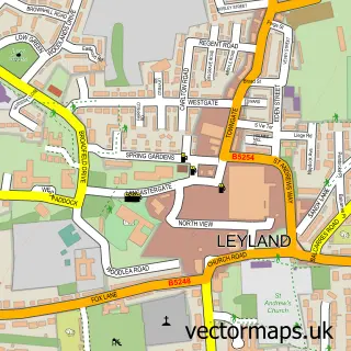
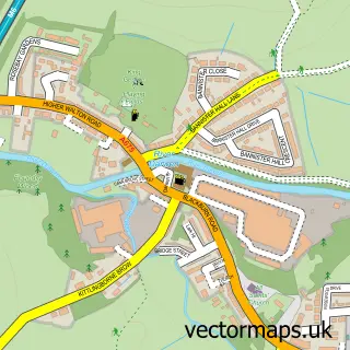
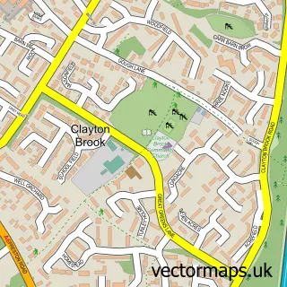
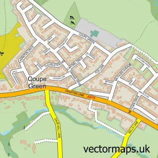
This Bamber Bridge street map is a detailed vector street map covering a 750m x 750m area. Select a larger area to create and download your own vector street map of Bamber Bridge.
The 750-metre map sample for Bamber Bridge covers 559 mapped buildings and approximately 19.2 km of road detail, of which 58 named roads are named. The immediate area includes 1 school, 1 railway station, 1 GP surgery, with 6 within 2 miles and 8 pubs among other local services. The wider area around Bamber Bridge features 2 tourism points of interest, 10 food and drink venues and 2 hotels. To create a larger or custom map of Bamber Bridge, the map builder lets you define your own coverage area and download editable SVG, PDF and PNG files.
Create a larger editable map of Bamber Bridge
Choose any area you need and generate a high-quality vector map instantly. Perfect for print, planning, design, business and personal use.

This Bamber Bridge street map in Lancashire is available as downloadable SVG, PDF and PNG map files, or as a printed map for planning, business, display, education, local information and design work. You can also create a larger custom map area using the map selector.
What this Bamber Bridge map sample shows
Bamber Bridge lies within Lancashire County parish, part of Bamber Bridge West ward in the South Ribble District (B) local authority area. The postcode geography for this area includes the PR postcode area, the PR5 postcode district and the PR5 6 postcode sector. Residents fall under the Nhs Lancashire And South Cumbria Integrated Care Board for NHS services.
Local features near Bamber Bridge
Within 2 milesAmenities and services in and around Bamber Bridge.
Administrative and postcode information for Bamber Bridge
The local authority covering Bamber Bridge is South Ribble District (B), within the county of Lancashire. The settlement lies within Bamber Bridge West ward and Lancashire County civil parish. The PR5 postcode district and PR5 6 postcode sector serve the immediate area. NHS provision in the area is delivered through Lancashire Teaching Hospitals Nhs Foundation Trust.
Nearby street map samples around Bamber Bridge

More street maps in Lancashire
750 metre map area coverage
Boundary, postcode and point of interest information for the 750m x 750m rectangle centred on this sample map.
Boundaries containing map centre
Constituency: Ribble Valley Co Const
County: Lancashire County
District: South Ribble District (B)
Icb: NHS Lancashire and South Cumbria ICB
Police Force: lancashire
Postcode District: PR5
Postcode Sector: PR5 6
Ward: Bamber Bridge East Ward
Nearby boundaries intersecting sample
Postcode Sector: PR5 4
Ward: Bamber Bridge West Ward
Postcode coverage
POI category counts
Beauty Salon: 13
Hair Salon: 9
Pub: 8
Beauty And Spa: 6
Real Estate Agent: 6
Printing Services: 5
Convenience Store: 4
Funeral Services And Cemeteries: 4
Professional Services: 4
Social Service Organizations: 4
Sample points of interest
- Mike Hankey & Co
- PWD Creative Solutions
- Pure Zen Therapy
- Jokerswildfuncasinohire
- PA Hire Northwest
- Direct Ear Care- Ear Wax Removal & Hearing Test Bamber Bridge
- AutoFlaunt Detailing
- Financial Minefield
- North West Garage Services
- Glovers Bakery
- Greenhalghs
- ATM (TSB)
Create a larger editable map of Bamber Bridge
This sample shows only a 750 metre area. To create a larger map of Bamber Bridge, use our map builder to choose your own coverage area, add titles and download editable SVG, PDF and PNG files.
Create a custom map of Bamber Bridge