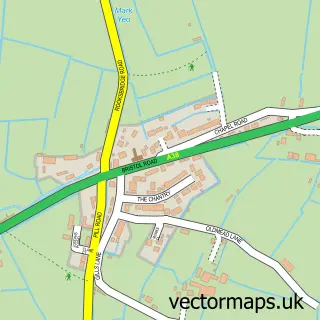
This Mark street map is a detailed vector street map covering a 750m x 750m area. Select a larger area to create and download your own vector street map of Mark.
The 750-metre map sample for Mark covers 230 mapped buildings and approximately 14.5 km of road detail, of which 14 named roads are named. The immediate area includes 2 pubs and 1 MOT station. The wider area around Mark features 1 tourism point of interest, 2 food and drink venues and 1 campsite within 2 miles. To create a larger or custom map of Mark, the map builder lets you define your own coverage area and download editable SVG, PDF and PNG files.
Create a larger editable map of Mark
Choose any area you need and generate a high-quality vector map instantly. Perfect for print, planning, design, business and personal use.

This Mark street map in Somerset is available as downloadable SVG, PDF and PNG map files, or as a printed map for planning, business, display, education, local information and design work. You can also create a larger custom map area using the map selector.
What this Mark map sample shows
Mark lies within Mark Cp parish, part of Wedmore And Mark ward in the Somerset local authority area. The postcode geography for this area includes the TA postcode area, the TA9 postcode district and the TA9 4 postcode sector. Residents fall under the Nhs Somerset Integrated Care Board for NHS services.
Local features near Mark
Within 2 milesAmenities and services in and around Mark.
Administrative and postcode information for Mark
The local authority covering Mark is Somerset, within the county of Somerset. The settlement lies within Wedmore And Mark ward and Mark Cp civil parish. The TA9 postcode district and TA9 4 postcode sector serve the immediate area. NHS provision in the area is delivered through University Hospitals Bristol And Weston Nhs Foundation Trust.
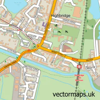
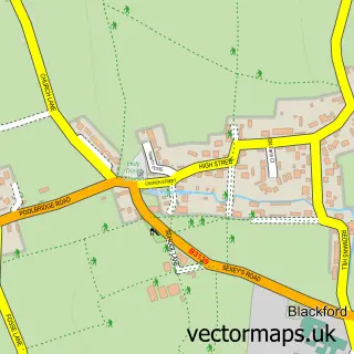
Nearby street map samples around Mark


More street maps in Somerset
750 metre map area coverage
Boundary, postcode and point of interest information for the 750m x 750m rectangle centred on this sample map.
Boundaries containing map centre
Constituency: Wells and Mendip Hills Co Const
District: Somerset
Icb: NHS Somerset ICB
Parish: Mark CP
Police Force: avon and somerset
Postcode District: TA9
Postcode Sector: TA9 4
Nearby boundaries intersecting sample
No additional intersecting boundaries found.
Postcode coverage
POI category counts
Convenience Store: 3
Beauty And Spa: 2
Church Cathedral: 2
Pub: 2
Anglican Church: 1
Attractions And Activities: 1
Auto Upholstery: 1
Automotive Repair: 1
Caterer: 1
Community Center: 1
Sample points of interest
- Holy Cross
- Finley Field Mini Foot Golf at White Horse Inn
- Heritage Upholsterers
- Averys Garage
- Nicolas1salon
- The Zen Den - Hair
- Mark Country Catering
- Church of St Mark, Mark
- Church of the Holy Cross
- Mark Village Hall
- Londis LONDIS - MARK VILLAGE STORES
- Mark Village Store
Create a larger editable map of Mark
This sample shows only a 750 metre area. To create a larger map of Mark, use our map builder to choose your own coverage area, add titles and download editable SVG, PDF and PNG files.
Create a custom map of Mark