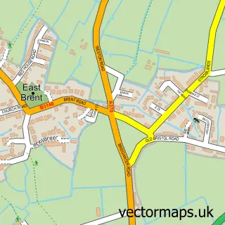
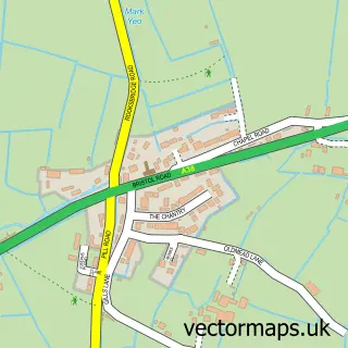
This Brent Knoll street map is a detailed vector street map covering a 750m x 750m area. Select a larger area to create and download your own vector street map of Brent Knoll.
The 750-metre map sample for Brent Knoll covers 173 mapped buildings and approximately 5.9 km of road detail, of which 9 named roads are named. The immediate area includes 1 school, 2 GP surgeries within 2 miles and 3 MOT stations within 2 miles. The wider area around Brent Knoll features 1 tourism point of interest and 2 campsites within 2 miles. To create a larger or custom map of Brent Knoll, the map builder lets you define your own coverage area and download editable SVG, PDF and PNG files.
Create a larger editable map of Brent Knoll
Choose any area you need and generate a high-quality vector map instantly. Perfect for print, planning, design, business and personal use.

This Brent Knoll street map in Somerset is available as downloadable SVG, PDF and PNG map files, or as a printed map for planning, business, display, education, local information and design work. You can also create a larger custom map area using the map selector.
What this Brent Knoll map sample shows
Brent Knoll lies within Brent Knoll Cp parish, part of Knoll ward in the Somerset local authority area. The postcode geography for this area includes the TA postcode area, the TA9 postcode district and the TA9 4 postcode sector. Residents fall under the Nhs Somerset Integrated Care Board for NHS services.
Local features near Brent Knoll
Within 2 milesAmenities and services in and around Brent Knoll.
Administrative and postcode information for Brent Knoll
Brent Knoll lies within Brent Knoll Cp parish, part of Knoll ward in the Somerset local authority area. The postcode geography for this area includes the TA postcode area, the TA9 postcode district and the TA9 4 postcode sector. Residents fall under the Nhs Somerset Integrated Care Board for NHS services.
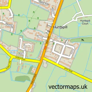
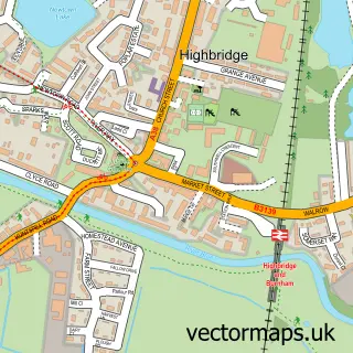
Nearby street map samples around Brent Knoll

More street maps in Somerset
750 metre map area coverage
Boundary, postcode and point of interest information for the 750m x 750m rectangle centred on this sample map.
Boundaries containing map centre
Constituency: Wells and Mendip Hills Co Const
District: Somerset
Icb: NHS Somerset ICB
Parish: Brent Knoll CP
Police Force: avon and somerset
Postcode District: TA9
Postcode Sector: TA9 4
Nearby boundaries intersecting sample
Parish: Burnham Without CP
Postcode coverage
POI category counts
Attractions And Activities: 1
Church Cathedral: 1
Dance School: 1
Elementary School: 1
Event Planning: 1
Florist: 1
Gardener: 1
Holiday Rental Home: 1
Industrial Equipment: 1
Retirement Home: 1
Sample points of interest
- Brent Knoll Hill
- St Michael's Church
- DanceFit
- Brent Knoll Primary School
- Brent Knoll Parish Hall
- Hedgemead Flowers
- Brent Garden Services
- Somerset Luxury Escapes
- Dirt Driver Limited
- Holywell Nursing Home
- Brent Knoll Tennis Club
Create a larger editable map of Brent Knoll
This sample shows only a 750 metre area. To create a larger map of Brent Knoll, use our map builder to choose your own coverage area, add titles and download editable SVG, PDF and PNG files.
Create a custom map of Brent Knoll