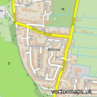
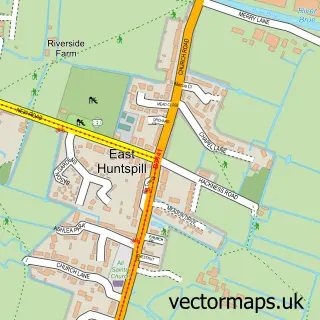
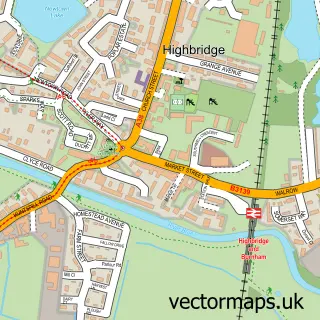
This Burnham-on-Sea street map is a detailed vector street map covering a 750m x 750m area. Select a larger area to create and download your own vector street map of Burnham-on-Sea.
The 750-metre map sample for Burnham-on-Sea covers 203 mapped buildings and approximately 14.5 km of road detail, of which 39 named roads are named. The immediate area includes 1 school, 1 GP surgery within 2 miles, 8 pubs and 4 MOT stations within 2 miles. The wider area around Burnham-on-Sea features 9 tourism points of interest, 31 food and drink venues and 4 hotels. To create a larger or custom map of Burnham-on-Sea, the map builder lets you define your own coverage area and download editable SVG, PDF and PNG files.
Create a larger editable map of Burnham-on-Sea
Choose any area you need and generate a high-quality vector map instantly. Perfect for print, planning, design, business and personal use.

This Burnham-on-Sea street map in Somerset is available as downloadable SVG, PDF and PNG map files, or as a printed map for planning, business, display, education, local information and design work. You can also create a larger custom map area using the map selector.
What this Burnham-on-Sea map sample shows
Burnham-on-Sea lies within Burnham-On-Sea And Highbridge Cp parish, part of Burnham North ward in the Somerset local authority area. The postcode geography for this area includes the TA postcode area, the TA8 postcode district and the TA8 1 postcode sector. Residents fall under the Nhs Somerset Integrated Care Board for NHS services.
Local features near Burnham-on-Sea
Within 2 milesAmenities and services in and around Burnham-on-Sea.
Administrative and postcode information for Burnham-on-Sea
Burnham-on-Sea lies within Burnham-On-Sea And Highbridge Cp parish, part of Burnham North ward in the Somerset local authority area. The postcode geography for this area includes the TA postcode area, the TA8 postcode district and the TA8 1 postcode sector. Residents fall under the Nhs Somerset Integrated Care Board for NHS services.
Nearby street map samples around Burnham-on-Sea

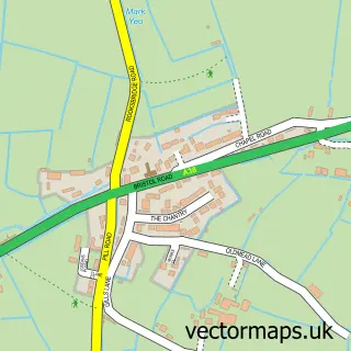
More street maps in Somerset
750 metre map area coverage
Boundary, postcode and point of interest information for the 750m x 750m rectangle centred on this sample map.
Boundaries containing map centre
Constituency: Bridgwater Co Const
District: Somerset
Icb: NHS Somerset ICB
Parish: Burnham-on-Sea and Highbridge CP
Police Force: avon and somerset
Postcode District: TA8
Postcode Sector: TA8 1
Nearby boundaries intersecting sample
Postcode Sector: TA8 2
Postcode coverage
POI category counts
Convenience Store: 11
Cafe: 10
Flowers And Gifts Shop: 10
Pub: 8
Real Estate Agent: 8
Restaurant: 7
Coffee Shop: 6
Funeral Services And Cemeteries: 6
Barber: 5
Beauty Salon: 5
Sample points of interest
- Westcotts Chartered Accountants & Business Advisers
- Inspiration Acupuncture
- Duke Design
- Burnham Pavilion
- Stardust Amusements
- Sunspot Amusements
- St Margarets Somerset Hospice
- Burnham Glass & Windows
- Magpie Vintage
- Pier Pavilion amusements
- Highly Strung Beads
- The Woolsack
Create a larger editable map of Burnham-on-Sea
This sample shows only a 750 metre area. To create a larger map of Burnham-on-Sea, use our map builder to choose your own coverage area, add titles and download editable SVG, PDF and PNG files.
Create a custom map of Burnham-on-Sea