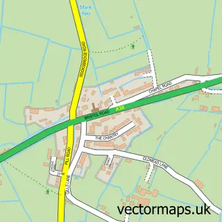
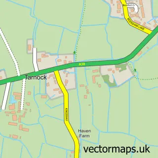
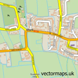
This East Brent street map is a detailed vector street map covering a 750m x 750m area. Select a larger area to create and download your own vector street map of East Brent.
The 750-metre map sample for East Brent covers 203 mapped buildings and approximately 13.5 km of road detail, of which 18 named roads are named. The immediate area includes 1 GP surgery, 1 pub and 1 MOT station within 2 miles. The wider area around East Brent features 1 food and drink venue and 1 campsite within 2 miles. To create a larger or custom map of East Brent, the map builder lets you define your own coverage area and download editable SVG, PDF and PNG files.
Create a larger editable map of East Brent
Choose any area you need and generate a high-quality vector map instantly. Perfect for print, planning, design, business and personal use.

This East Brent street map in Somerset is available as downloadable SVG, PDF and PNG map files, or as a printed map for planning, business, display, education, local information and design work. You can also create a larger custom map area using the map selector.
What this East Brent map sample shows
East Brent lies within East Brent Cp parish, part of Knoll ward in the Somerset local authority area. The postcode geography for this area includes the TA postcode area, the TA9 postcode district and the TA9 4 postcode sector. Residents fall under the Nhs Somerset Integrated Care Board for NHS services.
Local features near East Brent
Within 2 milesAmenities and services in and around East Brent.
Administrative and postcode information for East Brent
East Brent lies within East Brent Cp parish, part of Knoll ward in the Somerset local authority area. The postcode geography for this area includes the TA postcode area, the TA9 postcode district and the TA9 4 postcode sector. Residents fall under the Nhs Somerset Integrated Care Board for NHS services.
Nearby street map samples around East Brent

More street maps in Somerset
750 metre map area coverage
Boundary, postcode and point of interest information for the 750m x 750m rectangle centred on this sample map.
Boundaries containing map centre
Constituency: Wells and Mendip Hills Co Const
District: Somerset
Icb: NHS Somerset ICB
Parish: East Brent CP
Police Force: avon and somerset
Postcode District: TA9
Postcode Sector: TA9 4
Nearby boundaries intersecting sample
Postcode District: BS24
Postcode Sector: BS24 0
Postcode coverage
POI category counts
Driving School: 2
Beauty Salon: 1
Business Management Services: 1
Community Center: 1
Doctor: 1
Law Enforcement: 1
Medical Center: 1
Pub: 1
Retail: 1
Sample points of interest
- The Beauty Studio
- Thinking Data Ltd.
- East Brent Village Hall
- Brent Area Medical Centre
- L a Driving
- LA-Driving School
- Weston Investigations
- Wendy Kingdom
- Brent Knoll Inn
- Knight Systems
Create a larger editable map of East Brent
This sample shows only a 750 metre area. To create a larger map of East Brent, use our map builder to choose your own coverage area, add titles and download editable SVG, PDF and PNG files.
Create a custom map of East Brent