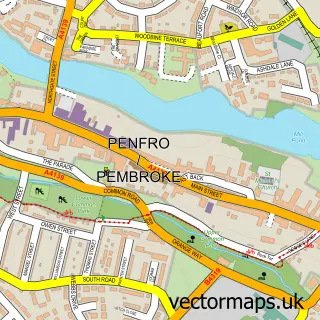
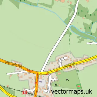
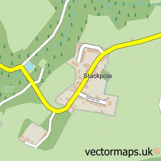
This Monkton street map is a detailed vector street map covering a 750m x 750m area. Select a larger area to create and download your own vector street map of Monkton.
The 750-metre map sample for Monkton covers 203 mapped buildings and approximately 9.4 km of road detail, of which 19 named roads are named. The immediate area includes 1 school, 1 GP surgery within 2 miles and 8 MOT stations within 2 miles. The wider area around Monkton features 1 food and drink venue. To create a larger or custom map of Monkton, the map builder lets you define your own coverage area and download editable SVG, PDF and PNG files.
Create a larger editable map of Monkton
Choose any area you need and generate a high-quality vector map instantly. Perfect for print, planning, design, business and personal use.

This Monkton street map in Dyfed is available as downloadable SVG, PDF and PNG map files, or as a printed map for planning, business, display, education, local information and design work. You can also create a larger custom map area using the map selector.
What this Monkton map sample shows
Monkton lies within Pembroke Community parish, part of Pembroke: St. Mary South ward in the Sir Benfro - Pembrokeshire local authority area. The postcode geography for this area includes the SA postcode area, the SA71 postcode district and the SA71 4 postcode sector. Residents fall under the Hywel Dda University Health Board for NHS services.
Local features near Monkton
Within 2 milesAmenities and services in and around Monkton.
Administrative and postcode information for Monkton
The local authority covering Monkton is Sir Benfro - Pembrokeshire, within the county of Dyfed. The settlement lies within Pembroke: St. Mary South ward and Pembroke Community civil parish. The SA71 postcode district and SA71 4 postcode sector serve the immediate area. NHS provision in the area is delivered through Hywel Dda University Health Board.
Nearby street map samples around Monkton

More street maps in Dyfed
750 metre map area coverage
Boundary, postcode and point of interest information for the 750m x 750m rectangle centred on this sample map.
Boundaries containing map centre
Constituency: Mid and South Pembrokeshire Co Const
District: Sir Benfro - Pembrokeshire
Icb: Hywel Dda
Parish: Pembroke Community
Police Force: dyfed-powys
Postcode District: SA71
Postcode Sector: SA71 4
Nearby boundaries intersecting sample
Postcode Sector: SA71 5
Postcode coverage
POI category counts
Atms: 2
Anglican Church: 1
Business To Business: 1
Cabin: 1
Cafe: 1
Church Cathedral: 1
Convenience Store: 1
Elementary School: 1
Farm: 1
Fish And Chips Restaurant: 1
Sample points of interest
- Pembroke, Monkton & Lamphey Churches
- ATM (Capper&Co. Spar Monkton)
- BR Spar Monkton, Monkton
- Wanton Wax & Wicked Wicks
- Dezza's Cabin
- Dezzas community cafe
- The Priory Church
- SPAR Monkton
- Monkton Priory Community Primary School
- Milton Farm Milton
- Monkton Friary Fish n Chips
- Guitar Repairs
Create a larger editable map of Monkton
This sample shows only a 750 metre area. To create a larger map of Monkton, use our map builder to choose your own coverage area, add titles and download editable SVG, PDF and PNG files.
Create a custom map of Monkton