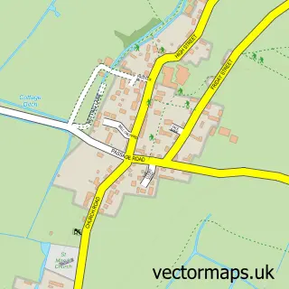
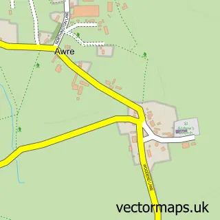
This Newnham on Severn street map is a detailed vector street map covering a 750m x 750m area. Select a larger area to create and download your own vector street map of Newnham on Severn.
The 750-metre map sample for Newnham on Severn covers 311 mapped buildings and approximately 33.7 km of road detail, of which 21 named roads are named. The immediate area includes 1 school, 1 pub and 1 MOT station within 2 miles. The wider area around Newnham on Severn features 4 food and drink venues. To create a larger or custom map of Newnham on Severn, the map builder lets you define your own coverage area and download editable SVG, PDF and PNG files.
Create a larger editable map of Newnham on Severn
Choose any area you need and generate a high-quality vector map instantly. Perfect for print, planning, design, business and personal use.

This Newnham on Severn street map in Gloucestershire is available as downloadable SVG, PDF and PNG map files, or as a printed map for planning, business, display, education, local information and design work. You can also create a larger custom map area using the map selector.
What this Newnham on Severn map sample shows
Newnham on Severn lies within Newnham Cp parish, part of Newnham ward in the Forest Of Dean District local authority area. The postcode geography for this area includes the GL postcode area, the GL14 postcode district and the GL14 1 postcode sector. Residents fall under the Nhs Gloucestershire Integrated Care Board for NHS services.
Local features near Newnham on Severn
Within 2 milesAmenities and services in and around Newnham on Severn.
Administrative and postcode information for Newnham on Severn
The local authority covering Newnham on Severn is Forest Of Dean District, within the county of Gloucestershire. The settlement lies within Newnham ward and Newnham Cp civil parish. The GL14 postcode district and GL14 1 postcode sector serve the immediate area. NHS provision in the area is delivered through Gloucestershire Hospitals Nhs Foundation Trust.
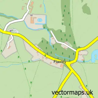
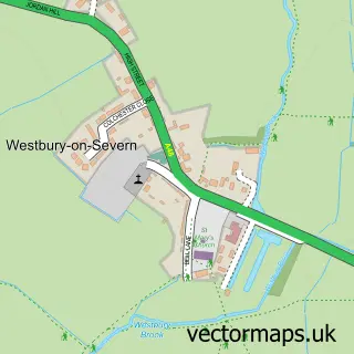
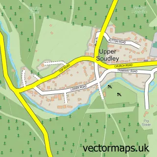
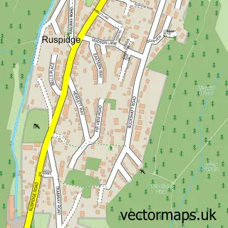
Nearby street map samples around Newnham on Severn

More street maps in Gloucestershire
750 metre map area coverage
Boundary, postcode and point of interest information for the 750m x 750m rectangle centred on this sample map.
Boundaries containing map centre
Constituency: Forest of Dean Co Const
County: Gloucestershire County
District: Forest of Dean District
Icb: NHS Gloucestershire ICB
Parish: Newnham CP
Police Force: gloucestershire
Postcode District: GL14
Postcode Sector: GL14 1
Ward: Newnham Ward
Nearby boundaries intersecting sample
District: Stroud District
Parish: Arlingham CP
Ward: Severn Ward
Postcode coverage
POI category counts
Building Supply Store: 4
Indian Restaurant: 3
Beauty Salon: 2
Convenience Store: 2
It Service And Computer Repair: 2
Jewelry Store: 2
Restaurant: 2
Shipping Center: 2
Advertising Agency: 1
Art Gallery: 1
Sample points of interest
- Paul Manning Design
- The Sanctuary Studio & Gallery
- Flutterby Cakes
- The Club
- JBK Hairdressing
- Diva
- Hand In Glove
- The Old House B&B
- D & a
- J D Plant Groundwork
- Tycoon Construction
- Wyedean Scaffolding
Create a larger editable map of Newnham on Severn
This sample shows only a 750 metre area. To create a larger map of Newnham on Severn, use our map builder to choose your own coverage area, add titles and download editable SVG, PDF and PNG files.
Create a custom map of Newnham on Severn