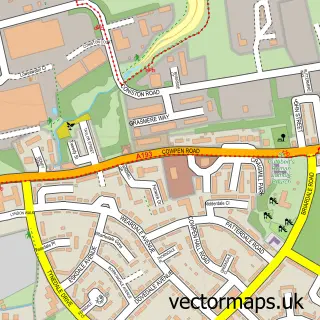
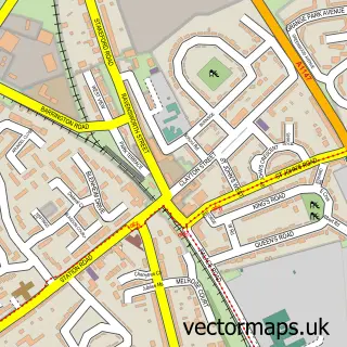
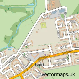
This Newsham street map is a detailed vector street map covering a 750m x 750m area. Select a larger area to create and download your own vector street map of Newsham.
The 750-metre map sample for Newsham covers 399 mapped buildings and approximately 21.0 km of road detail, of which 52 named roads are named. The immediate area includes 1 school, 2 GP surgeries within 2 miles, 3 pubs and 1 MOT station, with 12 within 2 miles. The wider area around Newsham features 1 tourism point of interest and 5 food and drink venues. To create a larger or custom map of Newsham, the map builder lets you define your own coverage area and download editable SVG, PDF and PNG files.
Create a larger editable map of Newsham
Choose any area you need and generate a high-quality vector map instantly. Perfect for print, planning, design, business and personal use.

This Newsham street map in Northumberland is available as downloadable SVG, PDF and PNG map files, or as a printed map for planning, business, display, education, local information and design work. You can also create a larger custom map area using the map selector.
What this Newsham map sample shows
Newsham lies within Blyth Cp parish, part of Newsham ward in the Northumberland local authority area. The postcode geography for this area includes the NE postcode area, the NE24 postcode district and the NE24 4 postcode sector. Residents fall under the Nhs North East And North Cumbria Integrated Care Board for NHS services.
Local features near Newsham
Within 2 milesAmenities and services in and around Newsham.
Administrative and postcode information for Newsham
Newsham lies within Blyth Cp parish, part of Newsham ward in the Northumberland local authority area. The postcode geography for this area includes the NE postcode area, the NE24 postcode district and the NE24 4 postcode sector. Residents fall under the Nhs North East And North Cumbria Integrated Care Board for NHS services.
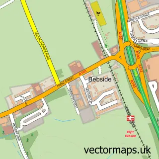
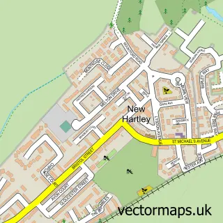
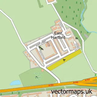
Nearby street map samples around Newsham

More street maps in Northumberland
750 metre map area coverage
Boundary, postcode and point of interest information for the 750m x 750m rectangle centred on this sample map.
Boundaries containing map centre
Constituency: Blyth and Ashington Co Const
District: Northumberland
Icb: NHS North East and North Cumbria ICB
Parish: Blyth CP
Police Force: northumberland
Postcode District: NE24
Postcode Sector: NE24 4
Nearby boundaries intersecting sample
Postcode Sector: NE24 2, NE24 3, NE24 5
Postcode coverage
POI category counts
Convenience Store: 6
Pub: 3
Social Service Organizations: 3
Automotive Repair: 2
Beauty Salon: 2
Chinese Restaurant: 2
Church Cathedral: 2
Fast Food Restaurant: 2
Gas Station: 2
Grocery Store: 2
Sample points of interest
- PayPoint
- Tyred & Exhausted
- Tyred and Exhausted
- Jb Barbers
- Beyond Beauty
- Bronzed and Beautiful
- Susan's
- Chisholm Bookmakers
- Neil Bird & Son
- Chicken Cottage
- Avor Van Hire
- Blyth Caterers
Create a larger editable map of Newsham
This sample shows only a 750 metre area. To create a larger map of Newsham, use our map builder to choose your own coverage area, add titles and download editable SVG, PDF and PNG files.
Create a custom map of Newsham