Vector Maps logo
Home Why it works Popular maps Districts Samples Customizer Create Your Map
VectorMaps.uk
Home Popular maps Districts Samples Customizer Create Your Map Privacy Disclaimer
Home / UK Maps / Northumberland / Blyth Map

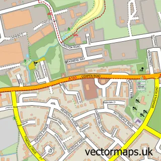
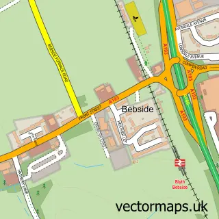
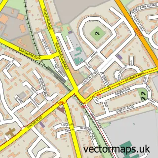
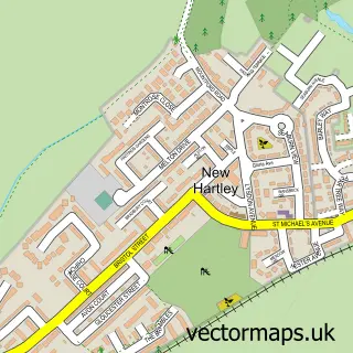
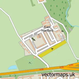
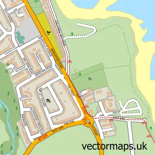
This Blyth street map is a detailed vector street map covering a 750m x 750m area. Select a larger area to create and download your own vector street map of Blyth.

Blyth is a town in Northumberland, in the North East of England. The settlement falls within the Blyth Valley parliamentary constituency. It is served by the NE24 postcode district, with NE24 1 as the local postcode sector.

The 750-metre map sample for Blyth covers 293 mapped buildings and approximately 28.1 km of road detail, of which 75 named roads are named. The immediate area includes 2 GP surgeries, 12 pubs and 2 MOT stations, with 12 within 2 miles. The wider area around Blyth features 5 tourism points of interest, 25 food and drink venues and 3 hotels. To create a larger or custom map of Blyth, the map builder lets you define your own coverage area and download editable SVG, PDF and PNG files.

293Buildings
28.05 kmRoads
75Named roads
18,203Residents within 2 miles
Create your own

Create a larger editable map of Blyth

Choose any area you need and generate a high-quality vector map instantly. Perfect for print, planning, design, business and personal use.

Choose any location
Editable SVG files
Any size up to A0
PDF, PNG & more
Instant download
High quality guaranteed
Create My Custom Map
Secure, private & no credit card required
Blyth Vector Street Map
750m Sample
Blyth vector street map sample showing roads, buildings and local features in a 750 metre preview area
Buy Blyth Map Print from £12.95 Buy Blyth Digital Map from £6

This Blyth street map in Northumberland is available as downloadable SVG, PDF and PNG map files, or as a printed map for planning, business, display, education, local information and design work. You can also create a larger custom map area using the map selector.

What this Blyth map sample shows

Blyth lies within Blyth Cp parish, part of Croft ward in the Northumberland local authority area. The postcode geography for this area includes the NE postcode area, the NE24 postcode district and the NE24 1 postcode sector. Residents fall under the Nhs North East And North Cumbria Integrated Care Board for NHS services.

Local features near Blyth

Within 2 miles

Amenities and services in and around Blyth.

2 GP surgeries 2 within 2 miles
2 MOT stations 12 within 2 miles
5 Tourism & leisure
25 Food & drink
12 Pubs
3 Hotels
19 Healthcare POIs
8 Vehicle services

Counts are approximate and based on publicly available data.

Administrative and postcode information for Blyth

The local authority covering Blyth is Northumberland, within the county of Northumberland. The settlement lies within Croft ward and Blyth Cp civil parish. The NE24 postcode district and NE24 1 postcode sector serve the immediate area. NHS provision in the area is delivered through Northumbria Healthcare Nhs Foundation Trust.

Parish Blyth CP
Ward Croft
District / local authority Northumberland
County Northumberland
Historic county Northumberland
Postcode district NE24
Postcode sector NE24 1
Parliamentary constituency Blyth Valley
Region North East
Country England

Nearby street map samples around Blyth

Street map sample of Newcastle upon Tyne, Tyne & Wear Newcastle upon Tyne City - Tyne & Wear - 11.3 miles Street map sample of Cowpen, Northumberland Cowpen Village - Northumberland - 1.3 miles Street map sample of Bebside, Northumberland Bebside Village - Northumberland - 2.0 miles Street map sample of Bedlington Station, Northumberland Bedlington Station Village - Northumberland - 2.5 miles Street map sample of New Hartley, Northumberland New Hartley Village - Northumberland - 2.9 miles Street map sample of East Hartford, Northumberland East Hartford Village - Northumberland - 3.2 miles Street map sample of West Sleekburn, Northumberland West Sleekburn Village - Northumberland - 3.2 miles Street map sample of Bomarsund, Northumberland Bomarsund Village - Northumberland - 3.3 miles Street map sample of Seaton Sluice, Northumberland Seaton Sluice Village - Northumberland - 3.3 miles Street map sample of Old Hartley, Northumberland Old Hartley Village - Northumberland - 3.8 miles

More street maps in Northumberland

Street map sample of Newsham, Northumberland Newsham Town - 1.3 miles Street map sample of Cowpen, Northumberland Cowpen Village - 1.3 miles Street map sample of Bebside, Northumberland Bebside Village - 2.0 miles Street map sample of Bedlington Station, Northumberland Bedlington Station Village - 2.5 miles Street map sample of New Hartley, Northumberland New Hartley Village - 2.9 miles

750 metre map area coverage

Boundary, postcode and point of interest information for the 750m x 750m rectangle centred on this sample map.

Boundaries containing map centre

Constituency: Blyth and Ashington Co Const

District: Northumberland

Icb: NHS North East and North Cumbria ICB

Parish: Blyth CP

Police Force: northumberland

Postcode District: NE24

Postcode Sector: NE24 1

Nearby boundaries intersecting sample

Parish: East Bedlington CP

Postcode Sector: NE24 2, NE24 3

Postcode coverage

NE24 NE24 1 NE24 2 NE24 3

POI category counts

Beauty Salon: 25

Hair Salon: 17

Pub: 12

Barber: 11

Discount Store: 11

Beauty And Spa: 10

Mobile Phone Store: 10

Bar: 9

Clothing Store: 9

Professional Services: 9

Sample points of interest

  • Dolly's Meat Market American Restaurant
  • Tyne Tees Entertainments Amusement Park
  • Victory Amusement Amusement Park
  • St Mary's Church Anglican Church
  • Kasbah Antiques Antique Store
  • Shelter Antique Store
  • Caterquip Ltd. Appliance Repair Service
  • Jackpot Amusements Arcade
  • Star Framing Arts And Crafts
  • The Guinness Partnership Assisted Living Facility
  • PayPoint Atms
  • ADG Auction Sale Room Auction House

Create a larger editable map of Blyth

This sample shows only a 750 metre area. To create a larger map of Blyth, use our map builder to choose your own coverage area, add titles and download editable SVG, PDF and PNG files.

Create a custom map of Blyth

Phone 01751 473136 | Copyright Vectormaps.uk 2026

Samples Customizer Privacy Disclaimer
Blyth Vector Street Map
Blyth enlarged street map sample showing a 750 metre preview area