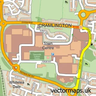
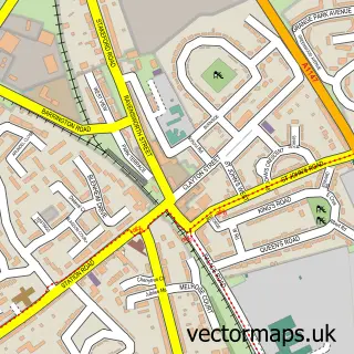
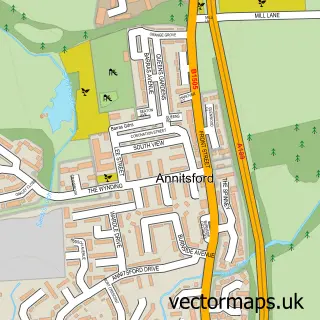
This East Hartford street map is a detailed vector street map covering a 750m x 750m area. Select a larger area to create and download your own vector street map of East Hartford.
The 750-metre map sample for East Hartford covers 106 mapped buildings and approximately 10.7 km of road detail, of which 9 named roads are named. The immediate area includes 1 school, 4 GP surgeries within 2 miles and 9 MOT stations within 2 miles. The wider area around East Hartford features 1 tourism point of interest. To create a larger or custom map of East Hartford, the map builder lets you define your own coverage area and download editable SVG, PDF and PNG files.
Create a larger editable map of East Hartford
Choose any area you need and generate a high-quality vector map instantly. Perfect for print, planning, design, business and personal use.

This East Hartford street map in Northumberland is available as downloadable SVG, PDF and PNG map files, or as a printed map for planning, business, display, education, local information and design work. You can also create a larger custom map area using the map selector.
What this East Hartford map sample shows
East Hartford lies within Cramlington Cp parish, part of Cramlington West ward in the Northumberland local authority area. The postcode geography for this area includes the NE postcode area, the NE23 postcode district and the NE23 3 postcode sector. Residents fall under the Nhs North East And North Cumbria Integrated Care Board for NHS services.
Local features near East Hartford
Within 2 milesAmenities and services in and around East Hartford.
Administrative and postcode information for East Hartford
East Hartford lies within Cramlington Cp parish, part of Cramlington West ward in the Northumberland local authority area. The postcode geography for this area includes the NE postcode area, the NE23 postcode district and the NE23 3 postcode sector. Residents fall under the Nhs North East And North Cumbria Integrated Care Board for NHS services.
Nearby street map samples around East Hartford

More street maps in Northumberland
750 metre map area coverage
Boundary, postcode and point of interest information for the 750m x 750m rectangle centred on this sample map.
Boundaries containing map centre
Constituency: Cramlington and Killingworth Co Const
District: Northumberland
Icb: NHS North East and North Cumbria ICB
Parish: Cramlington CP
Police Force: northumberland
Postcode District: NE23
Postcode Sector: NE23 3
Nearby boundaries intersecting sample
Constituency: Blyth and Ashington Co Const
Parish: Blyth CP
Postcode District: NE24
Postcode Sector: NE24 4
Postcode coverage
POI category counts
Amateur Sports Team: 1
Bar: 1
Bathroom Remodeling: 1
Carpet Store: 1
Community Center: 1
Contractor: 1
Freight And Cargo Service: 1
Land Surveying: 1
Martial Arts Club: 1
Musical Instrument Store: 1
Sample points of interest
- Cramlington Town FC
- The Crossbar
- Read & Gibbons
- BnC Laminate Flooring
- East Hartford Community Centre
- S.A. Groundworks Paving Services
- A M Courier Services
- Bowman Surveying and Design Ltd
- Eternal Martial Arts.
- Drumming Workshops
- East Hartford Small Park
- The Barkley Boutique - Pet Hotel
Create a larger editable map of East Hartford
This sample shows only a 750 metre area. To create a larger map of East Hartford, use our map builder to choose your own coverage area, add titles and download editable SVG, PDF and PNG files.
Create a custom map of East Hartford