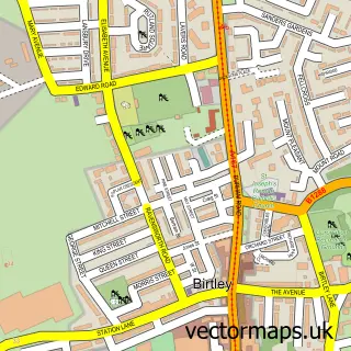
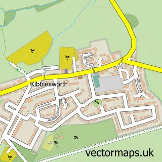
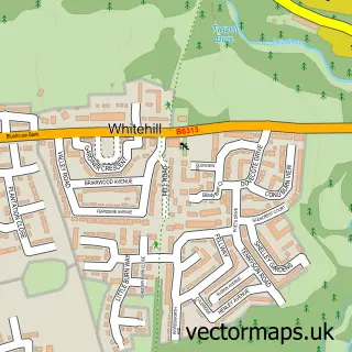
This Ouston street map is a detailed vector street map covering a 750m x 750m area. Select a larger area to create and download your own vector street map of Ouston.
The 750-metre map sample for Ouston covers 354 mapped buildings and approximately 18.1 km of road detail, of which 26 named roads are named. The immediate area includes 1 school, 3 GP surgeries within 2 miles and 11 MOT stations within 2 miles. To create a larger or custom map of Ouston, the map builder lets you define your own coverage area and download editable SVG, PDF and PNG files.
Create a larger editable map of Ouston
Choose any area you need and generate a high-quality vector map instantly. Perfect for print, planning, design, business and personal use.

This Ouston street map in Durham is available as downloadable SVG, PDF and PNG map files, or as a printed map for planning, business, display, education, local information and design work. You can also create a larger custom map area using the map selector.
What this Ouston map sample shows
Ouston lies within Ouston Cp parish, part of Pelton ward in the County Durham local authority area. The postcode geography for this area includes the DH postcode area, the DH2 postcode district and the DH2 1 postcode sector. Residents fall under the Nhs North East And North Cumbria Integrated Care Board for NHS services.
Local features near Ouston
Within 2 milesAmenities and services in and around Ouston.
Administrative and postcode information for Ouston
The local authority covering Ouston is County Durham, within the county of Durham. The settlement lies within Pelton ward and Ouston Cp civil parish. The DH2 postcode district and DH2 1 postcode sector serve the immediate area. NHS provision in the area is delivered through County Durham And Darlington Nhs Foundation Trust.
Nearby street map samples around Ouston

More street maps in Durham
750 metre map area coverage
Boundary, postcode and point of interest information for the 750m x 750m rectangle centred on this sample map.
Boundaries containing map centre
Constituency: North Durham Co Const
District: County Durham
Icb: NHS North East and North Cumbria ICB
Parish: Ouston CP
Police Force: durham
Postcode District: DH2
Postcode Sector: DH2 1
Nearby boundaries intersecting sample
Parish: Urpeth CP
Postcode coverage
POI category counts
Building Supply Store: 2
Community Center: 2
Gas Station: 2
Martial Arts Club: 2
Post Office: 2
Beauty Salon: 1
Carpenter: 1
Cleaning Services: 1
Computer Store: 1
Contractor: 1
Sample points of interest
- Urban Attraction Hair and Beauty
- Artificial Intelligence
- Contract & Consultancy Services UK
- Sas Joinery Services
- Lowes Cleaning
- Ouston Community Association
- Ouston Community Centre
- Computer Assistance
- Durham City Builders
- Londis
- Petra Furlong Childcare
- Leadwork Northeast
Create a larger editable map of Ouston
This sample shows only a 750 metre area. To create a larger map of Ouston, use our map builder to choose your own coverage area, add titles and download editable SVG, PDF and PNG files.
Create a custom map of Ouston