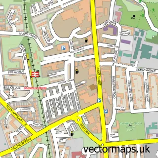
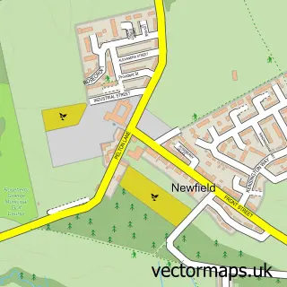
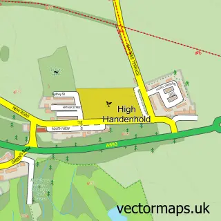
This South Pelaw street map is a detailed vector street map covering a 750m x 750m area. Select a larger area to create and download your own vector street map of South Pelaw.
The 750-metre map sample for South Pelaw covers 462 mapped buildings and approximately 20.3 km of road detail, of which 32 named roads are named. The immediate area includes 1 school, 6 GP surgeries within 2 miles, 1 pub and 1 MOT station, with 8 within 2 miles. The wider area around South Pelaw features 2 tourism points of interest and 1 food and drink venue. To create a larger or custom map of South Pelaw, the map builder lets you define your own coverage area and download editable SVG, PDF and PNG files.
Create a larger editable map of South Pelaw
Choose any area you need and generate a high-quality vector map instantly. Perfect for print, planning, design, business and personal use.

This South Pelaw street map in Durham is available as downloadable SVG, PDF and PNG map files, or as a printed map for planning, business, display, education, local information and design work. You can also create a larger custom map area using the map selector.
What this South Pelaw map sample shows
South Pelaw lies within County Durham parish, part of Chester-Le-Street East ward in the County Durham local authority area. The postcode geography for this area includes the DH postcode area, the DH3 postcode district and the DH3 3 postcode sector. Residents fall under the Nhs North East And North Cumbria Integrated Care Board for NHS services.
Local features near South Pelaw
Within 2 milesAmenities and services in and around South Pelaw.
Administrative and postcode information for South Pelaw
South Pelaw lies within County Durham parish, part of Chester-Le-Street East ward in the County Durham local authority area. The postcode geography for this area includes the DH postcode area, the DH3 postcode district and the DH3 3 postcode sector. Residents fall under the Nhs North East And North Cumbria Integrated Care Board for NHS services.
Nearby street map samples around South Pelaw

More street maps in Durham
750 metre map area coverage
Boundary, postcode and point of interest information for the 750m x 750m rectangle centred on this sample map.
Boundaries containing map centre
Constituency: North Durham Co Const
District: County Durham
Icb: NHS North East and North Cumbria ICB
Police Force: durham
Postcode District: DH2
Postcode Sector: DH2 2
Nearby boundaries intersecting sample
Postcode District: DH3
Postcode Sector: DH2 1, DH3 3
Postcode coverage
POI category counts
Beauty Salon: 3
Convenience Store: 3
Building Contractor: 2
Building Supply Store: 2
Chinese Restaurant: 2
Elementary School: 2
Gas Station: 2
Plumbing: 2
Roofing: 2
School: 2
Sample points of interest
- South Pelaw, Chester-le-Street
- Scuba Diver Training Ltd
- Les Spoors
- 100 Media UK
- Falcon Service Station
- Total Security (Northern)
- North East Auto Services
- InstaVolt Charging Station
- The Falcon
- Arima Brow's
- Beauty by Lucy
- Mane Street Hair Studio
Create a larger editable map of South Pelaw
This sample shows only a 750 metre area. To create a larger map of South Pelaw, use our map builder to choose your own coverage area, add titles and download editable SVG, PDF and PNG files.
Create a custom map of South Pelaw