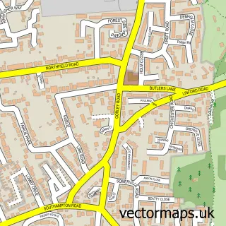
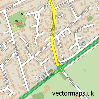
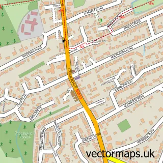
This Ringwood street map is a detailed vector street map covering a 750m x 750m area. Select a larger area to create and download your own vector street map of Ringwood.
The 750-metre map sample for Ringwood covers 268 mapped buildings and approximately 21.1 km of road detail, of which 40 named roads are named. The immediate area includes 1 school, 1 GP surgery, with 2 within 2 miles, 7 pubs and 2 MOT stations, with 10 within 2 miles. The wider area around Ringwood features 6 tourism points of interest and 24 food and drink venues. To create a larger or custom map of Ringwood, the map builder lets you define your own coverage area and download editable SVG, PDF and PNG files.
Create a larger editable map of Ringwood
Choose any area you need and generate a high-quality vector map instantly. Perfect for print, planning, design, business and personal use.

This Ringwood street map in Hampshire is available as downloadable SVG, PDF and PNG map files, or as a printed map for planning, business, display, education, local information and design work. You can also create a larger custom map area using the map selector.
What this Ringwood map sample shows
Ringwood lies within Ringwood Cp parish, part of Ringwood North ward in the New Forest District local authority area. The postcode geography for this area includes the BH postcode area, the BH24 postcode district and the BH24 1 postcode sector. Residents fall under the Nhs Hampshire And Isle Of Wight Integrated Care Board for NHS services.
Local features near Ringwood
Within 2 milesAmenities and services in and around Ringwood.
Administrative and postcode information for Ringwood
The local authority covering Ringwood is New Forest District, within the county of Hampshire. The settlement lies within Ringwood North ward and Ringwood Cp civil parish. The BH24 postcode district and BH24 1 postcode sector serve the immediate area. NHS provision in the area is delivered through University Hospitals Dorset Nhs Foundation Trust.
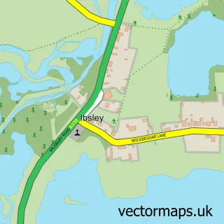
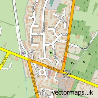
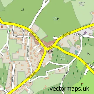
Nearby street map samples around Ringwood

More street maps in Hampshire
750 metre map area coverage
Boundary, postcode and point of interest information for the 750m x 750m rectangle centred on this sample map.
Boundaries containing map centre
Constituency: New Forest West Co Const
County: Hampshire County
District: New Forest District
Icb: NHS Hampshire and Isle of Wight ICB
Parish: Ringwood CP
Police Force: hampshire
Postcode District: BH24
Postcode Sector: BH24 1
Ward: Ringwood South Ward
Nearby boundaries intersecting sample
Postcode Sector: BH24 2, BH24 3
Ward: Ringwood North & Ellingham Ward
Postcode coverage
POI category counts
Clothing Store: 12
Hair Salon: 12
Jewelry Store: 11
Cafe: 10
Real Estate Agent: 10
Beauty Salon: 9
Financial Service: 8
Bank Credit Union: 7
Professional Services: 7
Pub: 7
Sample points of interest
- Artema
- Hub Chartered Accountants
- Burley - The New Forest
- Castleman Trailway
- Joanna Phillips
- Salutary Life
- Silverstone Design & Creative Services
- Social Goose
- Willoughby Stewart
- Dr Helen Allergy
- Lisa Skeffington - Freedom for you from anxiety
- Church of St Peter & St Paul, Ringwood
Create a larger editable map of Ringwood
This sample shows only a 750 metre area. To create a larger map of Ringwood, use our map builder to choose your own coverage area, add titles and download editable SVG, PDF and PNG files.
Create a custom map of Ringwood