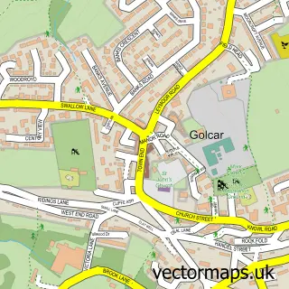
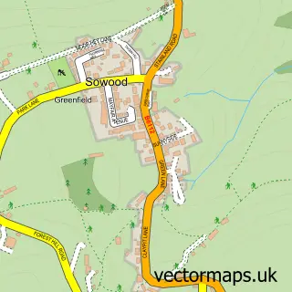
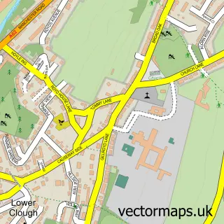
This Scapegoat Hill street map is a detailed vector street map covering a 750m x 750m area. Select a larger area to create and download your own vector street map of Scapegoat Hill.
The 750-metre map sample for Scapegoat Hill covers 265 mapped buildings and approximately 12.1 km of road detail, of which 21 named roads are named. The immediate area includes 1 school, 5 GP surgeries within 2 miles, 1 pub and 15 MOT stations within 2 miles. The wider area around Scapegoat Hill features 1 food and drink venue. To create a larger or custom map of Scapegoat Hill, the map builder lets you define your own coverage area and download editable SVG, PDF and PNG files.
Create a larger editable map of Scapegoat Hill
Choose any area you need and generate a high-quality vector map instantly. Perfect for print, planning, design, business and personal use.

This Scapegoat Hill street map in West Yorkshire is available as downloadable SVG, PDF and PNG map files, or as a printed map for planning, business, display, education, local information and design work. You can also create a larger custom map area using the map selector.
What this Scapegoat Hill map sample shows
Scapegoat Hill lies within Kirklees District (B) parish, part of Golcar ward in the Kirklees District (B) local authority area. The postcode geography for this area includes the HD postcode area, the HD7 postcode district and the HD7 4 postcode sector. Residents fall under the Nhs West Yorkshire Integrated Care Board for NHS services.
Local features near Scapegoat Hill
Within 2 milesAmenities and services in and around Scapegoat Hill.
Administrative and postcode information for Scapegoat Hill
The local authority covering Scapegoat Hill is Kirklees District (B), within the county of West Yorkshire. The settlement lies within Golcar ward and Kirklees District (B) civil parish. The HD7 postcode district and HD7 4 postcode sector serve the immediate area. NHS provision in the area is delivered through Calderdale And Huddersfield Nhs Foundation Trust.
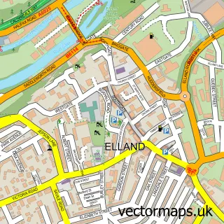
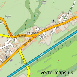
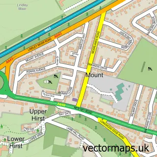
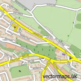
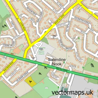
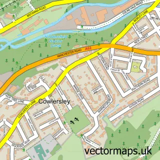
Nearby street map samples around Scapegoat Hill

More street maps in West Yorkshire
750 metre map area coverage
Boundary, postcode and point of interest information for the 750m x 750m rectangle centred on this sample map.
Boundaries containing map centre
Constituency: Colne Valley Co Const
District: Kirklees District (B)
Icb: NHS West Yorkshire ICB
Police Force: west yorkshire
Postcode District: HD7
Postcode Sector: HD7 4
Ward: Colne Valley Ward
Nearby boundaries intersecting sample
Ward: Golcar Ward
Postcode coverage
POI category counts
Professional Services: 3
Pet Services: 2
Accountant: 1
Agricultural Service: 1
Appliance Repair Service: 1
Automotive: 1
Bar: 1
Building Supply Store: 1
Church Cathedral: 1
Construction Services: 1
Sample points of interest
- Sara Armitage
- Rayson UK
- A.B Kitchen Appliance Repairs
- R Moorhouse Used Car Sales
- Scapehouse Inn
- John Beaumont Plumbers & Electrician Ltd
- Scapegoat Hill Baptist Church
- Zenca
- Concept Music Agency
- Scapegoat Hill Junior and Infant School
- Rayson UK
- Cup Winning Seeds
Create a larger editable map of Scapegoat Hill
This sample shows only a 750 metre area. To create a larger map of Scapegoat Hill, use our map builder to choose your own coverage area, add titles and download editable SVG, PDF and PNG files.
Create a custom map of Scapegoat Hill