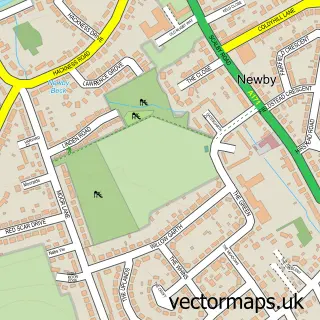
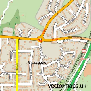
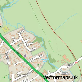
This Scarborough street map is a detailed vector street map covering a 750m x 750m area. Select a larger area to create and download your own vector street map of Scarborough.
The 750-metre map sample for Scarborough covers 168 mapped buildings and approximately 30.4 km of road detail, of which 86 named roads are named. The immediate area includes 1 school, 1 railway station, 1 GP surgery, with 5 within 2 miles and 34 pubs among other local services. The wider area around Scarborough features 14 tourism points of interest, 104 food and drink venues and 28 hotels. To create a larger or custom map of Scarborough, the map builder lets you define your own coverage area and download editable SVG, PDF and PNG files.
Create a larger editable map of Scarborough
Choose any area you need and generate a high-quality vector map instantly. Perfect for print, planning, design, business and personal use.

This Scarborough street map in North Yorkshire is available as downloadable SVG, PDF and PNG map files, or as a printed map for planning, business, display, education, local information and design work. You can also create a larger custom map area using the map selector.
What this Scarborough map sample shows
Scarborough lies within North Yorkshire parish, part of Castle ward in the North Yorkshire local authority area. The postcode geography for this area includes the YO postcode area, the YO11 postcode district and the YO11 1 postcode sector. Residents fall under the Nhs Humber And North Yorkshire Integrated Care Board for NHS services.
Local features near Scarborough
Within 2 milesAmenities and services in and around Scarborough.
Administrative and postcode information for Scarborough
Scarborough lies within North Yorkshire parish, part of Castle ward in the North Yorkshire local authority area. The postcode geography for this area includes the YO postcode area, the YO11 postcode district and the YO11 1 postcode sector. Residents fall under the Nhs Humber And North Yorkshire Integrated Care Board for NHS services.
Nearby street map samples around Scarborough

More street maps in North Yorkshire
750 metre map area coverage
Boundary, postcode and point of interest information for the 750m x 750m rectangle centred on this sample map.
Boundaries containing map centre
Constituency: Scarborough and Whitby Co Const
District: North Yorkshire
Icb: NHS Humber and North Yorkshire ICB
Parish: Scarborough CP
Police Force: north yorkshire
Postcode District: YO11
Postcode Sector: YO11 1
Nearby boundaries intersecting sample
Postcode District: YO12
Postcode Sector: YO11 2, YO12 7
Postcode coverage
POI category counts
Beauty Salon: 35
Pub: 34
Jewelry Store: 32
Hotel: 28
Cafe: 27
Bar: 25
Coffee Shop: 24
Hair Salon: 23
Clothing Store: 20
Flowers And Gifts Shop: 19
Sample points of interest
- M Wasley Chapman & Co
- Fused Design
- Iamcallum
- B Wharton
- East Coast Kitchen
- Hickory's Road House
- Coney Island
- Age UK
- Antique and Collectors Centre
- Barnardo's
- Deeps Antiques
- Harry's Antiques and Collectables
Create a larger editable map of Scarborough
This sample shows only a 750 metre area. To create a larger map of Scarborough, use our map builder to choose your own coverage area, add titles and download editable SVG, PDF and PNG files.
Create a custom map of Scarborough