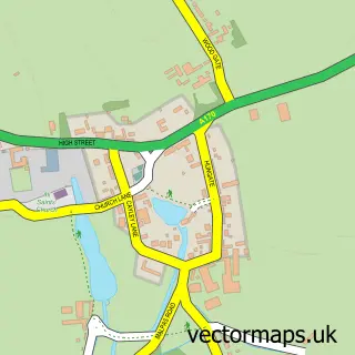
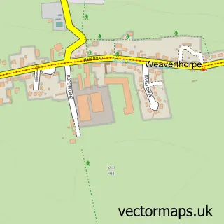
This Sherburn street map is a detailed vector street map covering a 750m x 750m area. Select a larger area to create and download your own vector street map of Sherburn.
The 750-metre map sample for Sherburn covers 216 mapped buildings and approximately 9.5 km of road detail, of which 14 named roads are named. The immediate area includes 1 school, 1 GP surgery and 2 pubs. The wider area around Sherburn features 2 tourism points of interest, 2 food and drink venues and 1 campsite within 2 miles. To create a larger or custom map of Sherburn, the map builder lets you define your own coverage area and download editable SVG, PDF and PNG files.
Create a larger editable map of Sherburn
Choose any area you need and generate a high-quality vector map instantly. Perfect for print, planning, design, business and personal use.

This Sherburn street map in North Yorkshire is available as downloadable SVG, PDF and PNG map files, or as a printed map for planning, business, display, education, local information and design work. You can also create a larger custom map area using the map selector.
What this Sherburn map sample shows
Sherburn lies within Sherburn Cp parish, part of Sherburn ward in the North Yorkshire local authority area. The postcode geography for this area includes the YO postcode area, the YO17 postcode district and the YO17 8 postcode sector. Residents fall under the Nhs Humber And North Yorkshire Integrated Care Board for NHS services.
Local features near Sherburn
Within 2 milesAmenities and services in and around Sherburn.
Administrative and postcode information for Sherburn
The local authority covering Sherburn is North Yorkshire, within the county of North Yorkshire. The settlement lies within Sherburn ward and Sherburn Cp civil parish. The YO17 postcode district and YO17 8 postcode sector serve the immediate area. NHS provision in the area is delivered through York And Scarborough Teaching Hospitals Nhs Foundation Trust.
Nearby street map samples around Sherburn

More street maps in North Yorkshire
750 metre map area coverage
Boundary, postcode and point of interest information for the 750m x 750m rectangle centred on this sample map.
Boundaries containing map centre
Constituency: Thirsk and Malton Co Const
District: North Yorkshire
Icb: NHS Humber and North Yorkshire ICB
Parish: Sherburn CP
Police Force: north yorkshire
Postcode District: YO17
Postcode Sector: YO17 8
Nearby boundaries intersecting sample
No additional intersecting boundaries found.
Postcode coverage
POI category counts
Industrial Equipment: 2
Pet Groomer: 2
Post Office: 2
Pub: 2
Sports Club And League: 2
Automotive Parts And Accessories: 1
Bar: 1
Beauty Salon: 1
Campground: 1
Commercial Industrial: 1
Sample points of interest
- Wheelies Vintage Tractor Spares
- East Riding Hotel
- The Shed Hair and Beauty
- Oskada Park
- Kingspan Profiles and Sections
- Ryedale Citizens Advice Bureau
- Central store
- Evri ParcelShop
- Post Office Travel Money
- Sherburn Surgery
- Cool K9
- Sherburn Church of England Voluntary Controlled Primary School
Create a larger editable map of Sherburn
This sample shows only a 750 metre area. To create a larger map of Sherburn, use our map builder to choose your own coverage area, add titles and download editable SVG, PDF and PNG files.
Create a custom map of Sherburn