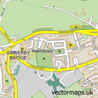
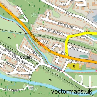
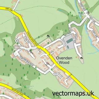
This Sowerby Bridge street map is a detailed vector street map covering a 750m x 750m area. Select a larger area to create and download your own vector street map of Sowerby Bridge.
The 750-metre map sample for Sowerby Bridge covers 270 mapped buildings and approximately 28.4 km of road detail, of which 86 named roads are named. The immediate area includes 1 school, 1 railway station, 1 GP surgery, with 6 within 2 miles and 12 pubs among other local services. The wider area around Sowerby Bridge features 3 tourism points of interest, 25 food and drink venues and 2 hotels. To create a larger or custom map of Sowerby Bridge, the map builder lets you define your own coverage area and download editable SVG, PDF and PNG files.
Create a larger editable map of Sowerby Bridge
Choose any area you need and generate a high-quality vector map instantly. Perfect for print, planning, design, business and personal use.

This Sowerby Bridge street map in West Yorkshire is available as downloadable SVG, PDF and PNG map files, or as a printed map for planning, business, display, education, local information and design work. You can also create a larger custom map area using the map selector.
What this Sowerby Bridge map sample shows
Sowerby Bridge lies within Calderdale District (B) parish, part of Sowerby Bridge ward in the Calderdale District (B) local authority area. The postcode geography for this area includes the HX postcode area, the HX6 postcode district and the HX6 2 postcode sector. Residents fall under the Nhs West Yorkshire Integrated Care Board for NHS services.
Local features near Sowerby Bridge
Within 2 milesAmenities and services in and around Sowerby Bridge.
Administrative and postcode information for Sowerby Bridge
Sowerby Bridge lies within Calderdale District (B) parish, part of Sowerby Bridge ward in the Calderdale District (B) local authority area. The postcode geography for this area includes the HX postcode area, the HX6 postcode district and the HX6 2 postcode sector. Residents fall under the Nhs West Yorkshire Integrated Care Board for NHS services.
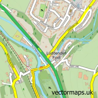
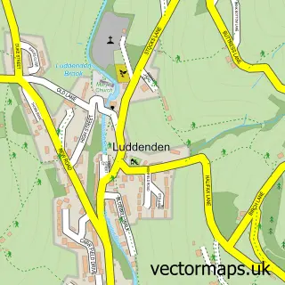
Nearby street map samples around Sowerby Bridge

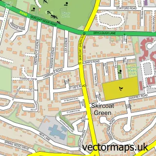
More street maps in West Yorkshire
750 metre map area coverage
Boundary, postcode and point of interest information for the 750m x 750m rectangle centred on this sample map.
Boundaries containing map centre
Constituency: Halifax Boro Const
District: Calderdale District (B)
Icb: NHS West Yorkshire ICB
Police Force: west yorkshire
Postcode District: HX6
Postcode Sector: HX6 2
Ward: Sowerby Bridge Ward
Nearby boundaries intersecting sample
Constituency: Calder Valley Co Const
Postcode Sector: HX6 1, HX6 3
Ward: Greetland and Stainland Ward
Postcode coverage
POI category counts
Beauty Salon: 12
Pub: 12
Barber: 10
Hair Salon: 8
Indian Restaurant: 8
Cafe: 7
Automotive Repair: 6
Professional Services: 6
Bar: 5
Flowers And Gifts Shop: 5
Sample points of interest
- Kenneth F Forsyth Associates
- Bridge Bodywork Clinic
- Hypnoacupuncture
- Old Cawsey
- Sue Ryder Care
- Hawdon Russell Architects
- Ryburn Gallery
- Bamboo Tree Chinese Takeaway
- PayPoint
- Hear Happy at Sowerby Bridge
- Hearing Check at Sowerby Bridge
- Alpine Restorations Automotive
Create a larger editable map of Sowerby Bridge
This sample shows only a 750 metre area. To create a larger map of Sowerby Bridge, use our map builder to choose your own coverage area, add titles and download editable SVG, PDF and PNG files.
Create a custom map of Sowerby Bridge