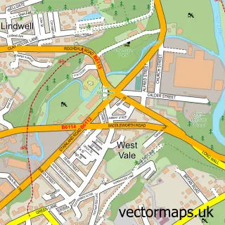
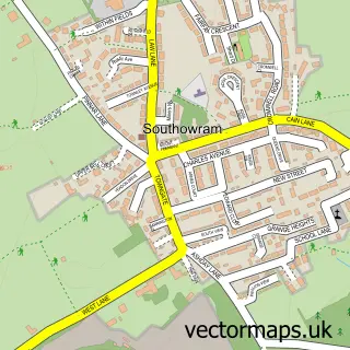
This Copley street map is a detailed vector street map covering a 750m x 750m area. Select a larger area to create and download your own vector street map of Copley.
The 750-metre map sample for Copley covers 304 mapped buildings and approximately 15.3 km of road detail, of which 22 named roads are named. The immediate area includes 1 school, 7 GP surgeries within 2 miles, 2 pubs and 1 MOT station, with 47 within 2 miles. The wider area around Copley features 3 tourism points of interest, 3 food and drink venues and 1 campsite within 2 miles. To create a larger or custom map of Copley, the map builder lets you define your own coverage area and download editable SVG, PDF and PNG files.
Create a larger editable map of Copley
Choose any area you need and generate a high-quality vector map instantly. Perfect for print, planning, design, business and personal use.

This Copley street map in West Yorkshire is available as downloadable SVG, PDF and PNG map files, or as a printed map for planning, business, display, education, local information and design work. You can also create a larger custom map area using the map selector.
What this Copley map sample shows
Copley lies within Calderdale District (B) parish, part of Greetland And Stainland ward in the Calderdale District (B) local authority area. The postcode geography for this area includes the HX postcode area, the HX4 postcode district and the HX4 8 postcode sector. Residents fall under the Nhs West Yorkshire Integrated Care Board for NHS services.
Local features near Copley
Within 2 milesAmenities and services in and around Copley.
Administrative and postcode information for Copley
The local authority covering Copley is Calderdale District (B), within the county of West Yorkshire. The settlement lies within Greetland And Stainland ward and Calderdale District (B) civil parish. The HX4 postcode district and HX4 8 postcode sector serve the immediate area. NHS provision in the area is delivered through Calderdale And Huddersfield Nhs Foundation Trust.
Nearby street map samples around Copley

More street maps in West Yorkshire
750 metre map area coverage
Boundary, postcode and point of interest information for the 750m x 750m rectangle centred on this sample map.
Boundaries containing map centre
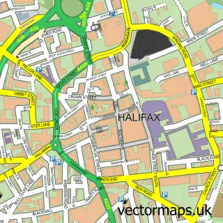
Constituency: Halifax Boro Const
District: Calderdale District (B)
Icb: NHS West Yorkshire ICB
Police Force: west yorkshire
Postcode District: HX3
Postcode Sector: HX3 0
Ward: Skircoat Ward
Nearby boundaries intersecting sample
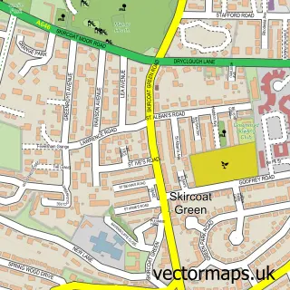
Constituency: Calder Valley Co Const
Postcode District: HX4
Postcode Sector: HX4 8
Ward: Greetland and Stainland Ward
Postcode coverage
POI category counts
Beauty Salon: 3
Driving School: 3
Car Dealer: 2
Carpet Store: 2
Dentist: 2
Gym: 2
Landmark And Historical Building: 2
Pub: 2
Spas: 2
Accountant: 1
Sample points of interest
- Pemberton Bookkeeping
- Old Rishworthian RUFC
- Phoenix Bowmen
- Rybrook Copley Land Rover
- The Bakery
- Standard of Freedom
- Gawjuss
- Sarah's Beauty and Aesthetic Rooms
- The Nail Shed Hx
- Rybrook Land Rover, Halifax
- Stonelake of Halifax Independent Land Rover and Range Rover Specialist
- Future Flooring Ltd
Create a larger editable map of Copley
This sample shows only a 750 metre area. To create a larger map of Copley, use our map builder to choose your own coverage area, add titles and download editable SVG, PDF and PNG files.
Create a custom map of Copley