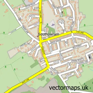
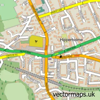
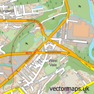
This Bank Top street map is a detailed vector street map covering a 750m x 750m area. Select a larger area to create and download your own vector street map of Bank Top.
The 750-metre map sample for Bank Top covers 250 mapped buildings and approximately 13.0 km of road detail, of which 20 named roads are named. The immediate area includes 5 GP surgeries within 2 miles, 1 pub and 40 MOT stations within 2 miles. The wider area around Bank Top features 1 tourism point of interest and 1 food and drink venue. To create a larger or custom map of Bank Top, the map builder lets you define your own coverage area and download editable SVG, PDF and PNG files.
Create a larger editable map of Bank Top
Choose any area you need and generate a high-quality vector map instantly. Perfect for print, planning, design, business and personal use.

This Bank Top street map in West Yorkshire is available as downloadable SVG, PDF and PNG map files, or as a printed map for planning, business, display, education, local information and design work. You can also create a larger custom map area using the map selector.
What this Bank Top map sample shows
Bank Top lies within Calderdale District (B) parish, part of Town ward in the Calderdale District (B) local authority area. The postcode geography for this area includes the HX postcode area, the HX3 postcode district and the HX3 9 postcode sector. Residents fall under the Nhs West Yorkshire Integrated Care Board for NHS services.
Local features near Bank Top
Within 2 milesAmenities and services in and around Bank Top.
Administrative and postcode information for Bank Top
Bank Top lies within Calderdale District (B) parish, part of Town ward in the Calderdale District (B) local authority area. The postcode geography for this area includes the HX postcode area, the HX3 postcode district and the HX3 9 postcode sector. Residents fall under the Nhs West Yorkshire Integrated Care Board for NHS services.
Nearby street map samples around Bank Top

More street maps in West Yorkshire
750 metre map area coverage
Boundary, postcode and point of interest information for the 750m x 750m rectangle centred on this sample map.
Boundaries containing map centre
Constituency: Halifax Boro Const
District: Calderdale District (B)
Icb: NHS West Yorkshire ICB
Police Force: west yorkshire
Postcode District: HX3
Postcode Sector: HX3 9
Ward: Town Ward
Nearby boundaries intersecting sample
No additional intersecting boundaries found.
Postcode coverage
POI category counts
Automotive Repair: 2
Convenience Store: 2
Bank Credit Union: 1
Barber: 1
Building Contractor: 1
Business Consulting: 1
Butcher Shop: 1
Construction Services: 1
Contractor: 1
Dance School: 1
Sample points of interest
- Brightside Recovery
- Ratcliffe Automotive
- Southowram Bank
- Tatt’s Barber’s
- C. Bingham Builders Ltd.
- Ilanguages
- Ingfield Butchers
- C Bingham Builders Ltd
- Millennium General Builders
- Premier
- Sams Mini Market
- Miss Stacey's School of Dance
Create a larger editable map of Bank Top
This sample shows only a 750 metre area. To create a larger map of Bank Top, use our map builder to choose your own coverage area, add titles and download editable SVG, PDF and PNG files.
Create a custom map of Bank Top