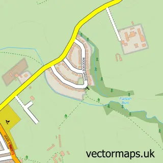
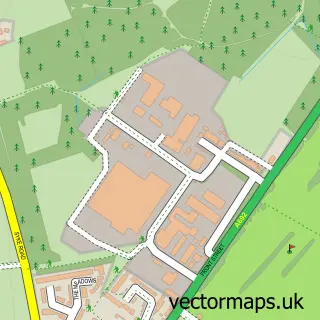
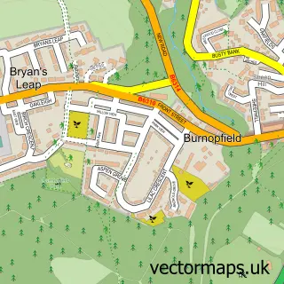
This Tanfield Lea street map is a detailed vector street map covering a 750m x 750m area. Select a larger area to create and download your own vector street map of Tanfield Lea.
The 750-metre map sample for Tanfield Lea covers 258 mapped buildings and approximately 13.7 km of road detail, of which 17 named roads are named. The immediate area includes 1 school, 5 GP surgeries within 2 miles and 14 MOT stations within 2 miles. The wider area around Tanfield Lea features 2 tourism points of interest. To create a larger or custom map of Tanfield Lea, the map builder lets you define your own coverage area and download editable SVG, PDF and PNG files.
Create a larger editable map of Tanfield Lea
Choose any area you need and generate a high-quality vector map instantly. Perfect for print, planning, design, business and personal use.

This Tanfield Lea street map in Durham is available as downloadable SVG, PDF and PNG map files, or as a printed map for planning, business, display, education, local information and design work. You can also create a larger custom map area using the map selector.
What this Tanfield Lea map sample shows
Tanfield Lea lies within Stanley Cp parish, part of Tanfield ward in the County Durham local authority area. The postcode geography for this area includes the DH postcode area, the DH9 postcode district and the DH9 9 postcode sector. Residents fall under the Nhs North East And North Cumbria Integrated Care Board for NHS services.
Local features near Tanfield Lea
Within 2 milesAmenities and services in and around Tanfield Lea.
Administrative and postcode information for Tanfield Lea
The local authority covering Tanfield Lea is County Durham, within the county of Durham. The settlement lies within Tanfield ward and Stanley Cp civil parish. The DH9 postcode district and DH9 9 postcode sector serve the immediate area. NHS provision in the area is delivered through County Durham And Darlington Nhs Foundation Trust.
Nearby street map samples around Tanfield Lea
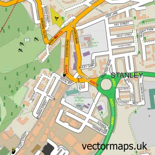

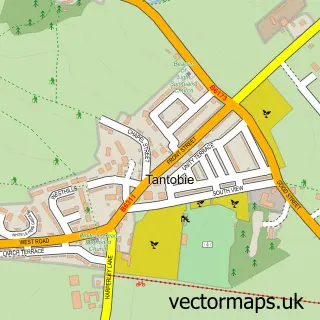
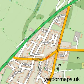
More street maps in Durham
750 metre map area coverage
Boundary, postcode and point of interest information for the 750m x 750m rectangle centred on this sample map.
Boundaries containing map centre
Constituency: North Durham Co Const
District: County Durham
Icb: NHS North East and North Cumbria ICB
Parish: Stanley CP
Police Force: durham
Postcode District: DH9
Postcode Sector: DH9 9
Nearby boundaries intersecting sample
Postcode Sector: DH9 8
Postcode coverage
POI category counts
Computer Store: 2
Arts And Crafts: 1
Atms: 1
Automotive Repair: 1
Bakery: 1
Barber: 1
Beauty And Spa: 1
Beauty Salon: 1
Business Manufacturing And Supply: 1
Carpet Cleaning: 1
Sample points of interest
- Designed with a Twist
- PayPoint
- Torque car centre
- Burnett 4 Cakes
- The Green Hut Barber Shop
- Anna Dance Beauty Room
- Noble Beauty
- K P Snacks
- Smartclean
- Stanley Work Wear Supplies
- Crystal View Professional Window Cleaning
- Crystalview Driveway Cleaning & Repairs
Create a larger editable map of Tanfield Lea
This sample shows only a 750 metre area. To create a larger map of Tanfield Lea, use our map builder to choose your own coverage area, add titles and download editable SVG, PDF and PNG files.
Create a custom map of Tanfield Lea