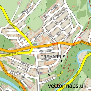
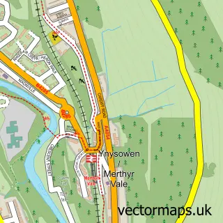
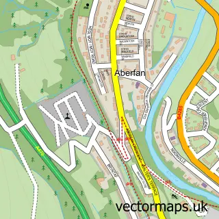
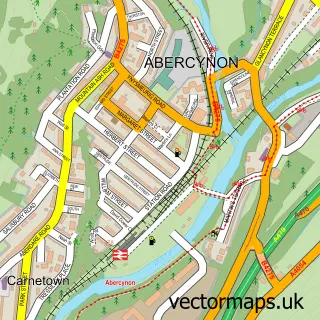
This Trelewis street map is a detailed vector street map covering a 750m x 750m area. Select a larger area to create and download your own vector street map of Trelewis.
The 750-metre map sample for Trelewis covers 201 mapped buildings and approximately 13.6 km of road detail, of which 18 named roads are named. The immediate area includes 1 school and 1 MOT station, with 4 within 2 miles. The wider area around Trelewis features 2 tourism points of interest, 1 food and drink venue and 1 hotel. To create a larger or custom map of Trelewis, the map builder lets you define your own coverage area and download editable SVG, PDF and PNG files.
Create a larger editable map of Trelewis
Choose any area you need and generate a high-quality vector map instantly. Perfect for print, planning, design, business and personal use.

This Trelewis street map in Mid Glamorgan is available as downloadable SVG, PDF and PNG map files, or as a printed map for planning, business, display, education, local information and design work. You can also create a larger custom map area using the map selector.
What this Trelewis map sample shows
Trelewis lies within Treharris Community parish, part of Treharris ward in the Merthyr Tudful - Merthyr Tydfil local authority area. The postcode geography for this area includes the CF postcode area, the CF46 postcode district and the CF46 5 postcode sector. Residents fall under the Cwm Taf University Health Board for NHS services.
Local features near Trelewis
Within 2 milesAmenities and services in and around Trelewis.
Administrative and postcode information for Trelewis
Trelewis lies within Treharris Community parish, part of Treharris ward in the Merthyr Tudful - Merthyr Tydfil local authority area. The postcode geography for this area includes the CF postcode area, the CF46 postcode district and the CF46 5 postcode sector. Residents fall under the Cwm Taf University Health Board for NHS services.
Nearby street map samples around Trelewis

More street maps in Mid Glamorgan
750 metre map area coverage
Boundary, postcode and point of interest information for the 750m x 750m rectangle centred on this sample map.
Boundaries containing map centre
Constituency: Merthyr Tydfil and Aberdare Co Const
District: Merthyr Tudful - Merthyr Tydfil
Icb: Cwm Taf University
Parish: Bedlinog Community
Police Force: south wales
Postcode District: CF46
Postcode Sector: CF46 6
Nearby boundaries intersecting sample
Parish: Treharris Community
Postcode Sector: CF46 5
Postcode coverage
POI category counts
Automotive Repair: 2
Convenience Store: 2
Newspaper And Magazines Store: 2
Advertising Agency: 1
Beauty Salon: 1
Ceiling Service: 1
Chinese Restaurant: 1
Elementary School: 1
Energy Company: 1
Food Delivery Service: 1
Sample points of interest
- Zebroid
- General and Commercial Motors
- Private Light Goods Services
- Mountain V Hair Lounge
- Classic Roofing
- New Golden Bridge (Open for Online Order)
- Premier
- Premier Trelewis Mini Market
- Trelewis Primary School
- Connected Kerb Charging Station
- Evri ParcelShop
- Treharris Athletic Western FC
Create a larger editable map of Trelewis
This sample shows only a 750 metre area. To create a larger map of Trelewis, use our map builder to choose your own coverage area, add titles and download editable SVG, PDF and PNG files.
Create a custom map of Trelewis