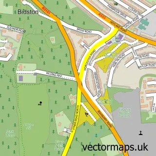
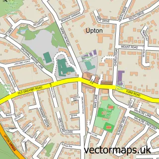
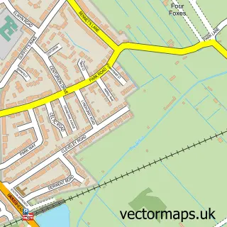
This Wallasey street map is a detailed vector street map covering a 750m x 750m area. Select a larger area to create and download your own vector street map of Wallasey.
The 750-metre map sample for Wallasey covers 475 mapped buildings and approximately 24.7 km of road detail, of which 67 named roads are named. The immediate area includes 1 school, 1 GP surgery, with 14 within 2 miles, 9 pubs and 2 MOT stations, with 38 within 2 miles. The wider area around Wallasey features 1 tourism point of interest, 12 food and drink venues and 1 hotel. To create a larger or custom map of Wallasey, the map builder lets you define your own coverage area and download editable SVG, PDF and PNG files.
Create a larger editable map of Wallasey
Choose any area you need and generate a high-quality vector map instantly. Perfect for print, planning, design, business and personal use.

This Wallasey street map in Merseyside is available as downloadable SVG, PDF and PNG map files, or as a printed map for planning, business, display, education, local information and design work. You can also create a larger custom map area using the map selector.
What this Wallasey map sample shows
Wallasey lies within Wirral District (B) parish, part of Wallasey ward in the Wirral District (B) local authority area. The postcode geography for this area includes the CH postcode area, the CH45 postcode district and the CH45 3 postcode sector. Residents fall under the Nhs Cheshire And Merseyside Integrated Care Board for NHS services.
Local features near Wallasey
Within 2 milesAmenities and services in and around Wallasey.
Administrative and postcode information for Wallasey
Wallasey lies within Wirral District (B) parish, part of Wallasey ward in the Wirral District (B) local authority area. The postcode geography for this area includes the CH postcode area, the CH45 postcode district and the CH45 3 postcode sector. Residents fall under the Nhs Cheshire And Merseyside Integrated Care Board for NHS services.
Nearby street map samples around Wallasey

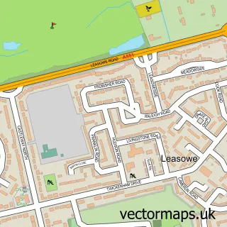
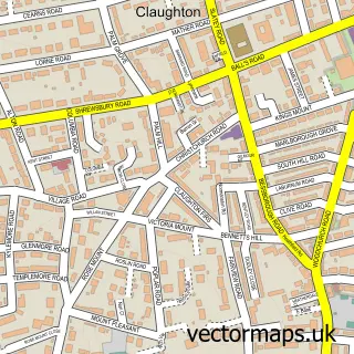
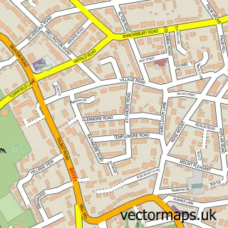
More street maps in Merseyside
750 metre map area coverage
Boundary, postcode and point of interest information for the 750m x 750m rectangle centred on this sample map.
Boundaries containing map centre
Constituency: Wallasey Boro Const
District: Wirral District (B)
Icb: NHS Cheshire and Merseyside ICB
Police Force: merseyside
Postcode District: CH45
Postcode Sector: CH45 7
Ward: New Brighton Ward
Nearby boundaries intersecting sample
Postcode District: CH44
Postcode Sector: CH44 0, CH44 1, CH45 1, CH45 4, CH45 5
Ward: Liscard Ward
Postcode coverage
POI category counts
Pub: 9
Retirement Home: 6
Church Cathedral: 4
Professional Services: 4
Assisted Living Facility: 3
Automotive Repair: 3
Convenience Store: 3
Doctor: 3
Elementary School: 3
Furniture Store: 3
Sample points of interest
- Kazi Ahmed & Co. Ltd.
- Cheshire Vikings JFC
- Carte Blanche Catering
- St Mary's Church, Liscard
- The fish shop wallasey
- Monkey House
- Kilburn House
- Mother Redcaps Nursing Home
- Newhaven Care
- Maddocks Garage
- Davies Car Clinic
- H & G Maddocks
Create a larger editable map of Wallasey
This sample shows only a 750 metre area. To create a larger map of Wallasey, use our map builder to choose your own coverage area, add titles and download editable SVG, PDF and PNG files.
Create a custom map of Wallasey