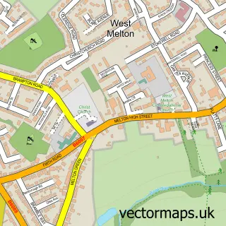
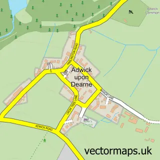
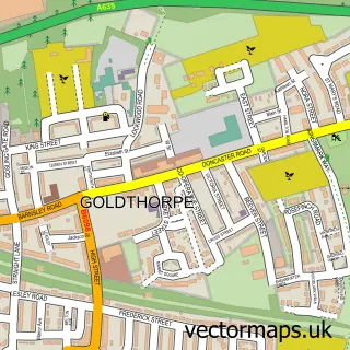
This Wath upon Dearne street map is a detailed vector street map covering a 750m x 750m area. Select a larger area to create and download your own vector street map of Wath upon Dearne.
The 750-metre map sample for Wath upon Dearne covers 311 mapped buildings and approximately 14.7 km of road detail, of which 31 named roads are named. The immediate area includes 2 schools, 1 GP surgery, with 2 within 2 miles, 8 pubs and 8 MOT stations within 2 miles. The wider area around Wath upon Dearne features 3 tourism points of interest and 15 food and drink venues. To create a larger or custom map of Wath upon Dearne, the map builder lets you define your own coverage area and download editable SVG, PDF and PNG files.
Create a larger editable map of Wath upon Dearne
Choose any area you need and generate a high-quality vector map instantly. Perfect for print, planning, design, business and personal use.

This Wath upon Dearne street map in South Yorkshire is available as downloadable SVG, PDF and PNG map files, or as a printed map for planning, business, display, education, local information and design work. You can also create a larger custom map area using the map selector.
What this Wath upon Dearne map sample shows
Wath upon Dearne lies within Rotherham District (B) parish, part of Wath ward in the Rotherham District (B) local authority area. The postcode geography for this area includes the S postcode area, the S63 postcode district and the S63 7 postcode sector. Residents fall under the Nhs South Yorkshire Integrated Care Board for NHS services.
Local features near Wath upon Dearne
Within 2 milesAmenities and services in and around Wath upon Dearne.
Administrative and postcode information for Wath upon Dearne
The local authority covering Wath upon Dearne is Rotherham District (B), within the county of South Yorkshire. The settlement lies within Wath ward and Rotherham District (B) civil parish. The S63 postcode district and S63 7 postcode sector serve the immediate area. NHS provision in the area is delivered through The Rotherham Nhs Foundation Trust.
Nearby street map samples around Wath upon Dearne

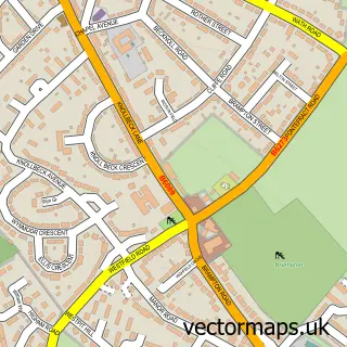
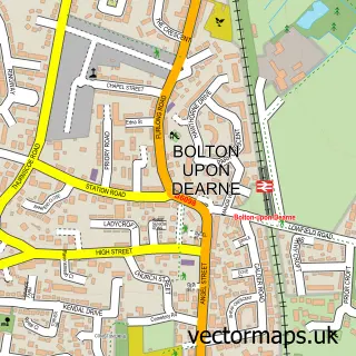
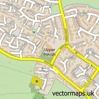
More street maps in South Yorkshire
750 metre map area coverage
Boundary, postcode and point of interest information for the 750m x 750m rectangle centred on this sample map.
Boundaries containing map centre
Constituency: Rawmarsh and Conisbrough Co Const
District: Rotherham District (B)
Icb: NHS South Yorkshire ICB
Police Force: south yorkshire
Postcode District: S63
Postcode Sector: S63 7
Ward: Wath Ward
Nearby boundaries intersecting sample
Postcode Sector: S63 6
Postcode coverage
POI category counts
Beauty Salon: 13
Pub: 8
Gym: 7
Church Cathedral: 5
Clothing Store: 5
Doctor: 5
Hair Salon: 5
Banks: 4
Bakery: 3
Building Supply Store: 3
Sample points of interest
- CPS Bookkeeping Services
- Dearne Accountancy Services
- Vie Medic Services Ltd
- The Little Curiosity Shoppe
- Mexborough Mash
- Cooplands
- GREGGS
- Staniforths
- Banking Hub
- Community Banker Wath Upon Dearne Banking Hub
- HSBC - Wath Upon Dearne - Temporary Banking Hub - HSBC staff are available Wednesday only
- Yorkshire Bank
Create a larger editable map of Wath upon Dearne
This sample shows only a 750 metre area. To create a larger map of Wath upon Dearne, use our map builder to choose your own coverage area, add titles and download editable SVG, PDF and PNG files.
Create a custom map of Wath upon Dearne