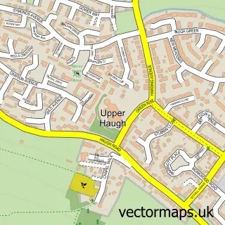
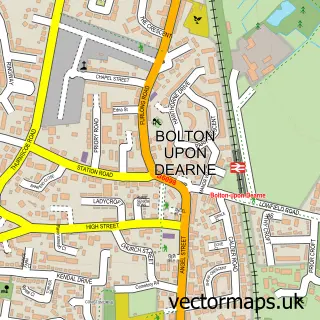
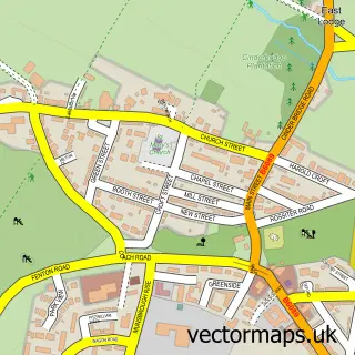
This Swinton street map is a detailed vector street map covering a 750m x 750m area. Select a larger area to create and download your own vector street map of Swinton.
The 750-metre map sample for Swinton covers 469 mapped buildings and approximately 24.4 km of road detail, of which 31 named roads are named. The immediate area includes 1 school, 5 GP surgeries within 2 miles, 5 pubs and 15 MOT stations within 2 miles. The wider area around Swinton features 1 tourism point of interest and 6 food and drink venues. To create a larger or custom map of Swinton, the map builder lets you define your own coverage area and download editable SVG, PDF and PNG files.
Create a larger editable map of Swinton
Choose any area you need and generate a high-quality vector map instantly. Perfect for print, planning, design, business and personal use.

This Swinton street map in South Yorkshire is available as downloadable SVG, PDF and PNG map files, or as a printed map for planning, business, display, education, local information and design work. You can also create a larger custom map area using the map selector.
What this Swinton map sample shows
Swinton lies within Rotherham District (B) parish, part of Wath ward in the Rotherham District (B) local authority area. The postcode geography for this area includes the S postcode area, the S64 postcode district and the S64 8 postcode sector. Residents fall under the Nhs South Yorkshire Integrated Care Board for NHS services.
Local features near Swinton
Within 2 milesAmenities and services in and around Swinton.
Administrative and postcode information for Swinton
The local authority covering Swinton is Rotherham District (B), within the county of South Yorkshire. The settlement lies within Wath ward and Rotherham District (B) civil parish. The S64 postcode district and S64 8 postcode sector serve the immediate area. NHS provision in the area is delivered through The Rotherham Nhs Foundation Trust.
Nearby street map samples around Swinton

More street maps in South Yorkshire
750 metre map area coverage
Boundary, postcode and point of interest information for the 750m x 750m rectangle centred on this sample map.
Boundaries containing map centre
Constituency: Rawmarsh and Conisbrough Co Const
District: Rotherham District (B)
Icb: NHS South Yorkshire ICB
Police Force: south yorkshire
Postcode District: S64
Postcode Sector: S64 8
Ward: Swinton Rockingham Ward
Nearby boundaries intersecting sample
No additional intersecting boundaries found.
Postcode coverage
POI category counts
Beauty Salon: 8
Pub: 5
Beauty And Spa: 2
Event Planning: 2
Fish And Chips Restaurant: 2
Hair Salon: 2
Professional Services: 2
Amateur Sports Team: 1
Auto Loan Provider: 1
Bakery: 1
Sample points of interest
- Swinton Athletic FC
- Jason Ward - Just Mortgages
- Sarah's Bakery Ltd
- Rockingham Tap | Swinton
- Turkish barber
- Brow Haus
- Nail Bible Education
- Dash 108
- Fancy Academy Limited
- Hidden Gem
- Jade Nails & Beauty
- Lexi Green Permanent Cosmetics and Semi Permanent Make-up
Create a larger editable map of Swinton
This sample shows only a 750 metre area. To create a larger map of Swinton, use our map builder to choose your own coverage area, add titles and download editable SVG, PDF and PNG files.
Create a custom map of Swinton